Agras T50 on a Low-Light Construction Site
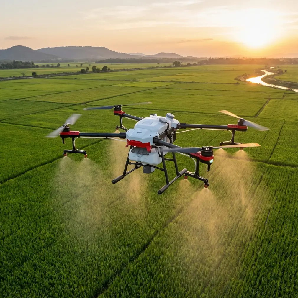
Agras T50 on a Low-Light Construction Site: A Case Study in Seeing Past the Preset
META: A field-based Agras T50 case study for low-light construction site scouting, focused on sensor judgment, RTK reliability, workflow logic, and what actually matters beyond image presets.
Most people ask the wrong question when they evaluate drone imagery from a difficult site.
They see a clean twilight survey pass, a readable embankment edge, a clear stockpile boundary, maybe enough shadow detail to flag standing water near a trench, and they ask: what settings did you use? What profile? What preset got that look?
That instinct is understandable. It is also the same mistake photographers make when they treat post-processing as a cosmetic layer instead of part of the image-making logic itself. One recent Chinese photography piece made that point sharply: people keep asking for the “parameters” behind a visual style, when the real issue sits deeper. The article argues that editing is not skin laid over a photograph, and it frames the craft around three underlying principles rather than a downloadable preset.
That idea maps surprisingly well to the Agras T50 in a low-light construction environment.
I have been asked to assess the T50 for dusk and pre-dawn site scouting, especially on active builds where managers want a fast aerial read before crews move in. On paper, that sounds like a question about cameras and image tuning. In the field, it is not. The useful question is whether the aircraft can produce decision-grade information when light is poor, surfaces are reflective, site geometry is messy, and timing is tight.
This case study comes from a contractor review I led on a partially graded infrastructure site after a day of rain. The aircraft in question was the Agras T50. The mission was not spraying. It was site scouting: drainage checks, haul-road condition review, access-path verification, material stack visibility, and edge awareness around newly cut sections before machines rolled at first light.
The reason this matters is simple. Low-light construction scouting is rarely defeated by one big failure. It is usually degraded by stacked small ones. Position drift. Inconsistent obstacle awareness. Poor route discipline. Water on the ground confusing the operator’s eye. Dust residue on optics. A wide swath of terrain that looks usable from one angle and dangerous from another. If you approach the T50 as a platform that merely captures images and then gets “fixed” later with a look, you miss what makes or breaks the sortie.
The site and the real objective
The build zone covered a long, irregular corridor with temporary access roads, drainage cuts, rebar staging, and a low retention area that had collected runoff overnight. The team wanted a fast pass before sunrise because they had two competing pressures: they needed enough visibility to identify hazards, but they also needed to move earth as early as possible to stay on schedule.
A low-light mission over construction terrain demands more than exposure discipline. It demands dependable spatial logic.
That is where one of the most overlooked T50 talking points becomes practical: centimeter precision. In agricultural discussion, that phrase is often tied to repeatability, lane discipline, and treatment accuracy. On a construction site, its operational significance shifts. Centimeter-level positioning helps the aircraft hold a more trustworthy path along narrow access corridors and around temporary obstacles, and it improves confidence when you need to compare one pass against another for drainage changes or material movement.
The same goes for RTK fix rate. People tend to treat RTK as a spec-sheet badge. In this scenario, it was the difference between a flight that simply looked smooth and one that generated usable site intelligence. In low light, the operator’s visual cues are weaker. That makes positioning quality more important, not less. A stable RTK solution supports tighter route fidelity, cleaner overlap behavior, and more dependable reference when reviewing where the aircraft was relative to cut lines, trench margins, or berm edges. If you are tracking a muddy access strip that was marginally passable last night and potentially compromised this morning, a weak positional story can make a clean-looking image set far less useful.
What the T50 did well when light was working against us
The strongest performance from the T50 was not aesthetic. It was behavioral.
The aircraft stayed composed in a setting where reflective puddles, low-angle ambient light, and mixed surface textures usually lead operators to overcorrect. That matters because construction scouting is often a confidence game in the wrong sense: pilots trust what “looks right” from the screen. A mature workflow trusts consistency, spatial awareness, and mission design first.
During one pass along the northern edge of the site, the drone’s sensing had to contend with an unexpected interruption. A pair of deer moved out from scrub near a spoil area and crossed toward the retention basin. It was brief, but it tested the practical value of a platform that can read a changing environment instead of treating the route as a rigid line through static space. On a civilian jobsite near undeveloped margins, wildlife encounters are not exotic. They are normal. The drone’s ability to navigate that moment without creating confusion for the operator mattered more than any image “look” ever could.
This is where construction readers should think beyond the usual agriculture vocabulary. Take swath width. In farm operations, swath width is usually discussed in relation to coverage efficiency. On a scouting mission, the same concept informs how much ground can be interpreted per pass and how much visual context the operator preserves around hazards. Too narrow, and you end up with fragmented reads of terrain transitions. Too broad, and critical details in low-contrast conditions can be harder to interpret quickly. The T50’s working footprint and route discipline created a practical middle ground: broad enough to understand the site as a system, controlled enough to inspect problem areas again without guesswork.
Why “preset thinking” fails on drone site scouting
That photography article I mentioned earlier made a useful distinction. If someone only asks for the preset, they are assuming the final appearance is something painted on after the fact. That is a misunderstanding of how a strong image comes together.
The same failure shows up in drone operations when teams reduce low-light scouting to screen brightness, contrast tweaks, or a preferred export style.
Here is the underlying logic I use with the Agras T50:
1. Capture starts with intent, not correction
If the task is drainage verification, your flight path, altitude, speed discipline, and revisit pattern must serve that task from the first minute. You cannot “grade” your way into useful drainage intelligence later if the route ignored the basin edges and access cuts that matter.
2. Position quality shapes interpretation
A reliable RTK fix rate is not a technical luxury. It affects whether your before-and-after comparisons actually align with site reality. Construction teams often make judgment calls off subtle differences: a stockpile moved two meters, runoff widened at one shoulder, trench spoil has crept into a path used by vehicles. Without strong positioning, those differences become harder to trust.
3. Environmental resilience matters more than visual polish
The T50’s IPX6K-rated protection has an obvious agricultural association, but its relevance on a construction site is easy to underestimate. Mud, fine particulate residue, wet vegetation at the site perimeter, and splash from recent rain all punish equipment. In low-light work, jobs often happen in the exact conditions that leave residue on the aircraft before the sun is even up. IPX6K does not make a careless workflow acceptable, but it does support dependable operation in the kind of dirty, damp environment where early-morning scouting usually happens.
That is the deeper lesson. The mission result is built before anyone touches a post-flight adjustment slider.
The terms people borrow from agriculture — and why they still matter here
The Agras T50 lives in an agricultural conversation, so some of its adjacent terminology can sound out of place on construction jobs. It is still useful if you interpret it correctly.
Spray drift, for example, is not part of a site-scouting sortie. But the thinking behind drift control does carry over. Drift management is fundamentally about environmental awareness, margin control, and respecting what happens when conditions push your operation off target. Construction scouting in low light has the same discipline. The penalty is different, but the principle is identical: if wind, moisture, terrain edge effects, or operator haste push the mission outside its intended envelope, the output becomes less trustworthy.
Nozzle calibration is another term that does not directly apply to a visual inspection pass, yet the mindset behind it absolutely does. Calibration culture means you do not assume the machine is “close enough.” You verify system behavior before asking it to support a serious decision. On a low-light construction mission, that means checking sensor cleanliness, route parameters, positional readiness, battery planning, and the operator’s display logic with the same seriousness an ag team would bring to application prep. Reliable scouting is not improvised.
Even multispectral gets mentioned loosely in these discussions, usually by people trying to make every drone sound like an all-in-one sensor solution. On this site, multispectral was not the point. We were not diagnosing crop vigor. We were trying to understand moisture retention, access viability, and hazard visibility in hard light conditions. The lesson is not that every advanced sensor mode should be used. The lesson is that mission design should stay loyal to the task. The T50 adds value when operators stop forcing a feature story and start building an information story.
A practical read on the output
By the time the site team reviewed the morning’s material, the most valuable findings were not glamorous.
A low section of the haul route showed more saturation than ground staff expected from their previous evening walk-through. A drainage line that appeared open from one side was partially obstructed by runoff debris. The spoil edge near the northern cut was safe enough for visual review but not for immediate machine approach from the planned angle. None of those decisions depended on cinematic color.
They depended on consistency.
That is why I keep returning to the photographer’s criticism of preset obsession. A visual style can be copied. Operational judgment cannot. The strongest T50 workflows for construction readers are the ones that stop asking how to reproduce a look and start asking how to create reliable interpretation under pressure.
If your team is trying to evaluate whether the Agras T50 fits low-light construction scouting, that is the framework I would suggest. Do not begin with “How sharp did the images look on a phone?” Begin with harder questions.
Did the aircraft maintain stable positional logic where human visual cues were weak?
Did the route preserve enough context to understand the site, not just isolated objects?
Did the sensor package and avoidance behavior reduce operator workload when the unexpected happened, including a wildlife crossing at the edge of the job?
Did the airframe hold up in wet, dirty, pre-dawn conditions consistent with an IPX6K-rated working platform?
If the answer to those questions is yes, then the output has value before anyone edits a frame.
The bigger takeaway for T50 buyers and operators
The Agras T50 is often discussed as though its worth is obvious from headline capability alone. That is not how serious field evaluation works. A machine proves itself when it reduces uncertainty on real jobs, with imperfect light, imperfect ground conditions, and imperfect timing.
On this construction site, the T50’s significance was not that it made low light look pretty. Its significance was that it helped the team see enough, trust enough, and act early enough.
That is a very different standard.
If you are comparing workflows or want to pressure-test a similar scouting setup, I can share the field checklist we use for these dawn and dusk sorties through this direct WhatsApp line: https://wa.me/85255379740
The best drone operations are built on underlying logic, not borrowed settings. That may sound like a photographer’s lesson, but on a construction site with thin light and wet ground, it becomes a management lesson too.
Ready for your own Agras T50? Contact our team for expert consultation.