Agras T50 in Dusty Vineyards: A Practical Monitoring
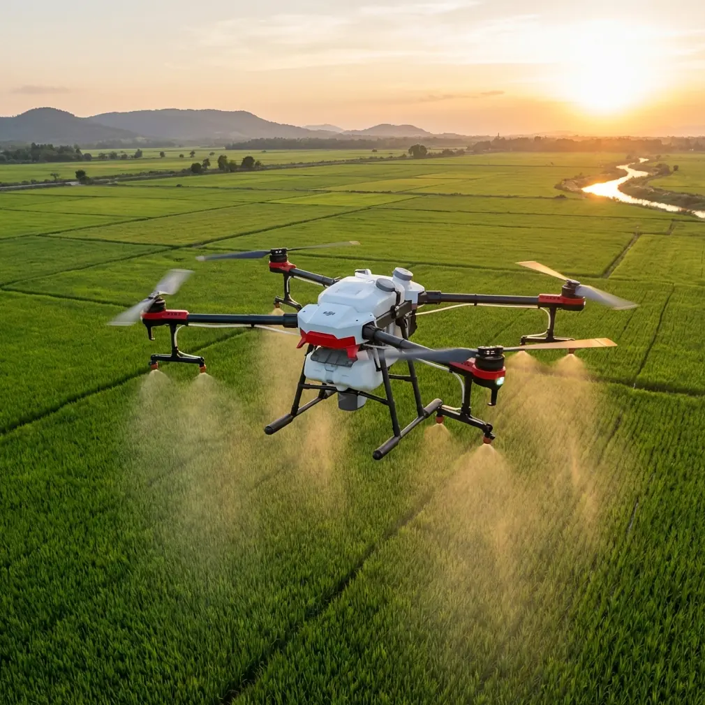
Agras T50 in Dusty Vineyards: A Practical Monitoring Framework That Starts Before the First Flight
META: Expert guide to using the Agras T50 for vineyard monitoring in dusty conditions, with operational insights on RTK stability, field data collection, hyperspectral crop intelligence, and precision workflows.
Dust changes everything in a vineyard.
It dulls visual cues on leaves. It can complicate sensor readings. It settles on airframes, connectors, and optics. In hilly blocks or roadside vineyards, it also tends to arrive with another headache: unstable signal conditions caused by metal infrastructure, power lines, pump houses, or other sources of electromagnetic interference. If your goal is to monitor vineyard variability with an Agras T50, that mix of dust, terrain, and interference can quietly erode data quality long before anyone notices a problem in the vines.
That is why the right conversation about the Agras T50 is not just about flight. It is about building a monitoring workflow that links three layers: stable aircraft positioning, clean field data capture, and agronomic interpretation that goes beyond “healthy” or “stressed.”
Recent policy signals in China reinforce this exact direction. The National Development and Reform Commission’s “低空启航、赋能未来” video series frames low-altitude operations through four application categories, including precise agricultural and forestry spraying and intelligent inspection. That matters for Agras T50 operators because it shows where the low-altitude economy is gaining traction: not merely in moving through airspace, but in delivering measurable field outcomes. For vineyards, monitoring sits at the intersection of both categories. You are effectively inspecting crop condition while preparing better-targeted field action.
The real vineyard problem: dusty conditions hide variability
In a dusty vineyard, visual scouting becomes less reliable. A block can appear uniformly tired when the real issue is patchy nutrient imbalance, irrigation inconsistency, or post-flowering stress concentrated in specific rows. Dust also weakens simple RGB interpretation because reflectance cues can be distorted by the film left on leaves and fruit-zone surfaces.
This is where the Agras T50 becomes more useful when it is treated as a node in a broader data workflow rather than as a standalone machine. The aircraft can cover ground efficiently, but the operational value comes from how accurately you tie those observations to mapped vineyard units, and how well you separate temporary surface contamination from underlying canopy physiology.
A useful reference point comes from the ArcGIS crop survey workflow documented for light UAV agricultural investigation. In that framework, a 200 meter by 200 meter sample plot is used as a defined survey unit, where parcels first sketched from satellite imagery are verified through field investigation to identify crop type and area. The number itself is not the main story. The significance is operational: structured sample units prevent UAV data from becoming just a large pile of imagery. In vineyards, the equivalent move is to break a dusty estate into manageable monitoring blocks, validate them against real row conditions, and then scale findings upward to ranch, district, or regional reporting.
With an Agras T50, this means your mission planning should begin with block logic, not battery logic. Where are the representative panels? Which rows are exposed to road dust? Which sections sit near trellis power systems or communication equipment? Where do elevation shifts create inconsistent deposition patterns? Monitoring gets sharper when each flight is tied to a field question.
Why RTK discipline matters more in vineyards than many operators admit
A vineyard is not a broadacre field. It is a narrow, repetitive geometry where small positioning errors can blur row-level interpretation. That makes RTK fix rate and centimeter precision especially relevant. In dusty environments, operators often focus on cleaning hardware and forget that poor positional consistency can do just as much damage to decision quality as a dirty lens.
If you are dealing with electromagnetic interference, antenna adjustment is not a cosmetic tweak. It can be the difference between a stable data layer and a misleading map.
The practical issue is simple. Interference near pump stations, overhead electrical infrastructure, or metal sheds can degrade GNSS reception quality or consistency. On a row crop survey this may show up as minor alignment drift. In vineyards, where canopy zones are tight and row spacing matters, that drift can make one weak row appear to contaminate its neighbor in the map.
A disciplined T50 monitoring setup in these areas should include:
- verifying RTK fix before entering the most interference-prone block
- adjusting antenna orientation and ground setup to reduce obstruction and local noise
- avoiding takeoff positions directly adjacent to reflective metal structures
- checking whether anomalies in the data repeat spatially in vine patterns or follow flight-path artifacts instead
This is where an academic mindset helps. Never treat a map as truth on first view. Treat it as evidence that needs context. If a stress signature appears as a neat band exactly parallel to a compromised signal segment, suspect acquisition error before prescribing agronomic action.
Dusty vineyards need monitoring that moves beyond surface color
One of the most underused ideas in vineyard UAV operations is that not all useful crop intelligence is visual. The hyperspectral reference material provided offers a stronger clue than many field teams realize.
The document on the Gaiasky mini hyperspectral imaging system notes that hyperspectral data can monitor not only chlorophyll content, but also chlorophyll density, red-edge characteristics, and other pigment information. It also points out that red-edge deformation can shift toward the blue under changing reflectance conditions. Operationally, this matters because dusty vineyards often produce misleading visible signatures while still preserving deeper spectral information about physiological condition.
For an Agras T50-centered workflow, even if the aircraft itself is not being discussed here as a dedicated hyperspectral platform, the agronomic lesson is clear: the best monitoring logic in dusty vineyards should be built to integrate richer spectral interpretation where possible, rather than relying on simple visual contrast alone.
That becomes even more compelling when quality, not just vigor, is the target. The same hyperspectral reference highlights that crop quality monitoring has become increasingly important and cites work linking canopy indices such as R1500/R610 and R1220/R560 with wheat grain protein and starch accumulation after heading. The crop is different, but the principle carries over. Spectral monitoring can support management decisions tied to crop quality traits, not only biomass or greenness.
In vineyards, that distinction is crucial. Many blocks do not need a map telling the manager where vines are alive. They need a map showing where canopy function is drifting enough to affect fruit development, ripening uniformity, or input timing. Dusty conditions make this harder to see with the naked eye. Spectral methods make it easier to recover signal from noise.
A better problem-solution model for the Agras T50
Let’s put this into a practical framework.
Problem 1: Dust masks canopy condition
Dust reduces confidence in visual inspection and can distort simplistic image interpretation.
Solution
Use the T50 as part of a layered observation program. Fly consistent block-based routes, maintain optics hygiene, and compare suspect zones against ground truth observations rather than making row decisions from imagery alone. If your operation is building a more advanced sensing stack, prioritize spectral indicators that reveal chlorophyll behavior and red-edge response instead of depending solely on apparent color.
Problem 2: Vineyard geometry punishes weak positioning
Narrow rows and small management zones magnify the impact of RTK instability.
Solution
Protect RTK fix quality as a first-order monitoring variable. In interference-prone sites, adjust antenna placement and orientation deliberately. Reposition the base or ground equipment away from metal clutter. Validate a short control segment before the full mission. Centimeter precision is not just a specification to quote; it is the basis for whether one mapped stress band actually belongs to that row.
Problem 3: Data collection often stops at imagery
Teams collect flight data but fail to connect it to a management structure.
Solution
Borrow the logic of the ArcGIS integrated field-and-office workflow. The key insight from the 200 m × 200 m sample plot method is that data gains value when it is tied to predefined field units and then validated through real-world observation. For vineyards, map your blocks first, define sample panels, capture field notes systematically, and push findings back into a GIS environment where irrigation zones, soil variation, disease history, and road exposure can be compared directly.
Problem 4: Monitoring is disconnected from action
A vineyard map is produced, discussed briefly, then archived.
Solution
Translate findings into operational triggers. A dusty edge block near access roads may need a different scouting interval than sheltered interior rows. A persistent stress cluster near a slope break may trigger irrigation checks. A spectral shift that appears before visible decline may justify earlier leaf tissue sampling. Monitoring is useful only when each output answers, “What should the team inspect next?”
The low-altitude economy context actually matters here
Policy language can feel distant from field reality, but the NDRC framing is relevant because it captures how agricultural drone operations are being understood at a systems level. The series does not isolate spraying as a narrow task. It places precise agricultural spraying alongside intelligent inspection, logistics, and convenient low-altitude mobility as major use cases showing how low-altitude technology is entering both production and everyday life.
For the Agras T50 reader, that broader lens is useful. In a modern vineyard, the aircraft’s role is expanding from task execution to decision support. Monitoring and treatment planning are converging. The more precise your block intelligence, the better your nozzle calibration strategy, row targeting, swath width decisions, and drift management become when field action follows.
That sequence matters in dusty conditions. Dust can increase the temptation to overreact with blanket intervention because everything looks uneven. Better monitoring helps prevent that. It lets operators distinguish a dust-driven surface effect from a true physiological problem, which in turn reduces unnecessary passes and supports tighter spray drift control.
Where inspection logic meets application logic
Even though this article is centered on monitoring, the Agras T50 audience usually thinks in mixed workflows. A vineyard team rarely monitors for curiosity. They monitor because they expect to act.
That is why inspection quality has direct implications for application quality:
- Better row-level location accuracy supports more reliable route planning.
- More credible block delineation improves swath width choices in irregular vineyard layouts.
- Stronger canopy diagnosis informs whether nozzle calibration should prioritize penetration, deposition pattern, or conservative output in sensitive sections.
- Earlier detection can reduce rushed response windows, which often lead to poor timing and higher drift risk.
In other words, monitoring is not a separate discipline. It is upstream spray quality control.
If your site is especially challenging, the fastest way to clean up repeat RTK or interference issues is to compare mission logs, map artifacts, and field conditions side by side with someone who understands both aircraft behavior and agronomy. If that would help, you can message a vineyard drone specialist directly here: https://wa.me/85255379740.
What experienced operators do differently with the T50 in dusty vineyards
The best operators I have seen do not chase perfect imagery. They chase trustworthy interpretation.
They know an IP-rated airframe helps, but resilience on paper does not eliminate dust management in practice. They clean consistently, watch connector integrity, and keep sensor surfaces in check. They do not assume every anomaly is biological. They ask whether a pattern could be explained by interference, angle, timing, or contamination. They use GIS structure to turn scattered observations into management zones. And they understand that the future of low-altitude agricultural work is not simply more flights. It is tighter linkage between aircraft data, field verification, and intervention timing.
That outlook aligns remarkably well with the reference materials. One source highlights precise agricultural work and intelligent monitoring as core low-altitude application scenes. Another shows how UAV crop investigation becomes operationally meaningful when survey areas are defined and tied to statistical outputs. A third makes the case that spectral monitoring can reveal far more than visible vigor, including signals related to chlorophyll behavior, carbon-nitrogen balance, and crop quality.
Put together, they point toward a smarter way to use the Agras T50 in vineyards: not as a flying camera alone, and not only as an application platform, but as part of a disciplined agronomic intelligence system.
For dusty vineyards, that shift is not academic. It is practical. It is how you stop mistaking surface noise for crop truth.
Ready for your own Agras T50? Contact our team for expert consultation.