Agras T50 for Coastal Highway Monitoring
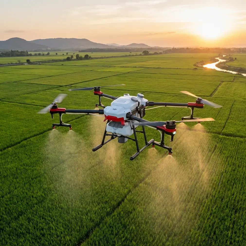
Agras T50 for Coastal Highway Monitoring: What Actually Matters When Conditions Shift
META: A field-focused look at using the Agras T50 for coastal highway monitoring, with practical insight on weather changes, flight control, precision, sensor integration, and operational reliability.
Highway monitoring along a coast has a way of exposing weak equipment and weak planning at the same time.
Salt in the air. Gust fronts that arrive early. Flat terrain that looks simple on a map but becomes complicated once glare, crosswinds, drainage channels, embankments, bridge joints, and traffic management all collide in one corridor. If you are evaluating the Agras T50 for this kind of job, the real question is not whether it can fly. The real question is whether it can keep data quality and mission control stable when the environment stops cooperating.
That is where the wider UAV industry context becomes useful.
A 2019 Chinese market research report identified the flight control system as the core of UAV performance, tying it directly to route control, mission equipment management, and information collection and transmission. That sounds abstract until you put a drone over a coastal highway. Then it becomes immediate. Monitoring work is not just about lifting a payload. It is about holding a planned path, preserving usable data, and managing the link between aircraft, sensors, and ground station when conditions start changing faster than the crew would like.
The same report also pointed to two structural shifts that helped civil drones scale: falling costs in chips, MEMS sensors, motors, and communications, and increasing integration of chips, sensors, and navigation systems. For a platform like the Agras T50, those trends matter because coastal monitoring is a systems problem. Reliable operation depends less on any one component than on how power, navigation, communications, and payload management work together in the field.
That is the lens through which the T50 should be judged.
The coastal highway problem is not flight. It is consistency.
A highway authority or contractor monitoring coastal infrastructure is usually trying to answer practical questions:
- Has drainage changed after rainfall or tide influence?
- Are shoulder edges eroding?
- Are bridge approaches moving or settling?
- Are barriers, slopes, or embankments showing visible deformation?
- Has vegetation encroachment altered visibility or access?
- Can repeated passes generate comparable records over time?
The technical challenge is repeatability. You need the aircraft to return with data that can be compared from one inspection window to the next, even when wind, humidity, and light behave differently each day.
This is where the Agras T50 enters the conversation in a slightly unexpected way. It is widely associated with agricultural operations, but the underlying demands of precision work are highly relevant to corridor monitoring. Concepts such as swath width discipline, nozzle calibration logic, and drift awareness all come from a world where overlap, distribution consistency, and environmental compensation are routine concerns. Translate that mindset into highway inspection and you get something useful: a more disciplined approach to route spacing, coverage uniformity, and weather-triggered operational adjustment.
In other words, the value is not in pretending a highway is a farm. The value is in borrowing the operational rigor that precision field work already requires.
Why the T50 conversation should start with flight control, not payload marketing
The reference material makes one point very clearly: the flight control system sits at the center of performance. It governs launch and recovery, trajectory control, task equipment management, and data transmission. That is especially relevant in coastal infrastructure work because route fidelity is the difference between a useful monitoring archive and a patchwork of flights that cannot be compared.
For a corridor mission, RTK fix rate and centimeter precision are not vanity metrics. They affect whether repeat passes line up tightly enough to support change detection. If your aircraft is drifting laterally across a highway shoulder because wind compensation is inconsistent or the fix quality is unstable, your downstream interpretation gets noisier. You may still get images. You may not get trustworthy comparisons.
That is why crews who use the T50 in monitoring-adjacent roles should think beyond raw endurance or lift capacity. The better question is this: does the aircraft maintain route discipline when the weather shifts and the mission still needs to be completed safely?
On a coastal route, that question stops being theoretical very quickly.
Mid-flight weather changes are where good planning earns its keep
On one typical coastal monitoring day, the mission can start in calm, bright conditions and then turn complicated within minutes. Marine airflow builds. Surface wind changes direction near bridge spans. Humidity thickens. Light contrast drops. A route that looked straightforward at takeoff suddenly needs active decision-making.
This is where many teams make the wrong move. They either push through mechanically or abort too late.
A better approach with the Agras T50 is to treat weather changes as a managed variable, not a surprise. If the wind begins to build mid-flight, the first operational concern is not speed for its own sake. It is whether the aircraft can preserve a stable path and whether the intended coverage geometry still makes sense. In agricultural work, crews already think this way because spray drift becomes unacceptable if wind changes beyond the usable envelope. For highway monitoring, the equivalent issue is spatial drift in coverage and reduced consistency in image geometry.
The logic carries over cleanly:
- If crosswind rises, route spacing may need adjustment.
- If visibility and contrast degrade, you may need to tighten capture strategy.
- If bridge sections create turbulence, you may split the mission and refly a segment rather than accept compromised data.
- If the RTK fix rate becomes inconsistent, centimeter-level repeatability is no longer something to assume.
That operational maturity matters more than pretending any aircraft is immune to weather. The T50 is most valuable when used by a crew that recognizes changing conditions early and knows how to preserve mission quality without forcing completion.
Bridge zones and corridor structures are where UAV monitoring proves its worth
The second reference document, from the 2014 China UAV Conference proceedings, is sparse but still useful because it explicitly points to bridge monitoring and to comparisons involving real-scene reconstruction and deformation data. That matters for coastal highways because bridges, culverts, overpasses, retaining structures, and transition slabs are often the places where visible change first appears.
The significance is not just “drones can inspect bridges.” We already know that. The operational significance is that UAV-based monitoring supports comparative workflows. If a previous pass provides a reconstruction baseline and a later pass reveals measurable change, the aircraft is no longer just collecting images. It is becoming part of a structured monitoring system.
That is where the Agras T50 can fit intelligently, particularly in programs where the drone is one layer inside a broader digital inspection routine. A consultant looking at coastal highways should think in terms of mission architecture:
- fixed repeatable routes
- strong RTK discipline
- image sets suitable for reconstruction
- structured weather logs
- segment-specific flight profiles around bridges and elevated sections
- comparison-ready outputs for engineering review
This is also why sensor choice matters. The source material mentions civil drone payload categories such as imaging cameras, mapping radar, and laser ranging. For coastal highway work, that points toward modular thinking. A standard visual workflow may be enough for surface condition review on some days. Other use cases may benefit from multispectral context for vegetation intrusion or moisture-related pattern tracking near shoulders and drainage paths. The payload is not the story by itself; the story is whether the aircraft-platform-and-sensor stack produces decision-grade information.
Salt, moisture, and hardware exposure change the risk profile
Coastal operations punish equipment in ways inland crews sometimes underestimate. Fine salt residue, moisture loading, and repeated exposure during launch, landing, and battery handling all increase maintenance pressure. That is why field durability details matter. When teams discuss the T50 in this context, features associated with robust weather resistance and practical clean-down routines become more than checklist items.
An IPX6K-oriented mindset is relevant here. Not because a protection rating solves every problem, but because coastal monitoring is full of contamination events that do not look dramatic while they are happening. The aircraft lands on a damp verge. Mist builds during a route extension. Salt film accumulates over repeated cycles. Reliability over time comes from how well the platform tolerates those realities and how disciplined the crew is about post-flight inspection.
This is also one reason the industry’s broader move toward integrated electronics and mature supply chains matters. The 2019 report linked lower component and communication costs with the explosive growth of civil drones. That growth is not just about affordability. It also reflects increasing practical usability. More mature sensors, motors, and communications architecture help make serious routine operations possible in environments that would have felt fragile a decade ago.
Open platforms changed expectations, even for operators who never write code
One of the most forward-looking points in the market report is its argument that open-source UAV platforms help organize fragmented software and hardware resources, speed up flight control development, and represent a mainstream future direction. Even if an Agras T50 operator is not directly building a custom controller, that shift still matters.
Why? Because it changed what the market expects from civilian drones.
Operators now expect easier integration, faster workflow adaptation, and more configurable mission logic. In coastal highway monitoring, that mindset shows up in the demand for cleaner data handoff, easier route replication, and smoother integration with engineering review systems. The aircraft is no longer judged in isolation. It is judged by how efficiently it plugs into inspection planning, field execution, and analysis after the flight.
That expectation should shape any T50 deployment plan. The drone is only one piece. The real deliverable is a monitoring workflow that can be repeated by the same team next week and by another team six months later without the quality collapsing.
If you are building that workflow and want to compare field setups or route logic with a specialist, this direct line can help: message a UAV consultant here.
Best-practice thinking for the T50 on coastal highways
A useful T50 highway monitoring program usually looks less glamorous than people imagine. It is built on habits.
Start with route discipline. Coastal corridors should be divided into segments based on exposure, structure density, and wind behavior, not just distance. A bridge approach should not be flown exactly like an open embankment section.
Then look at positioning quality. Centimeter precision only matters if the RTK fix rate remains strong enough to support repeatability. Log it. Review it. Do not assume it.
Next comes environmental adjustment. If weather changes mid-flight, the mission objective may shift from “finish everything” to “preserve comparability on the highest-priority sections.” That is not a compromise. That is good operations.
Borrow quality-control habits from precision spraying even if no liquid is involved. Spray drift awareness translates well into wind-awareness discipline. Nozzle calibration has a conceptual cousin in sensor alignment and mission geometry verification. Swath width thinking maps neatly to corridor coverage spacing and overlap control. The language is agricultural, but the operational lesson is broader: consistency beats improvisation.
Finally, pay attention to what the engineering team actually needs. A highways client usually does not want “drone data.” They want evidence of change, proof of stability, or early warning of a defect. Every flight parameter should serve that purpose.
What makes the Agras T50 relevant here
The Agras T50 becomes relevant to coastal highway monitoring when you stop viewing it as a simple aircraft choice and start viewing it as a field system. The reference materials support that perspective. One source emphasizes that the heart of UAV performance is flight control, including trajectory control, task management, and information transfer. Another points to bridge monitoring and reconstruction-based comparison as a meaningful application in engineering contexts. Taken together, those details frame the real issue: infrastructure monitoring succeeds when the aircraft can fly a stable, repeatable mission and collect comparable information around critical structures.
That is exactly the standard coastal corridors demand.
And when weather turns in the middle of the job, the operators who get useful results are rarely the ones with the most aggressive flight plan. They are the ones who understand precision, route integrity, and sensor discipline well enough to adapt without degrading the dataset.
That is the difference between flying a drone and running a monitoring program.
Ready for your own Agras T50? Contact our team for expert consultation.