Agras T50: Forest Monitoring Excellence in Low Light
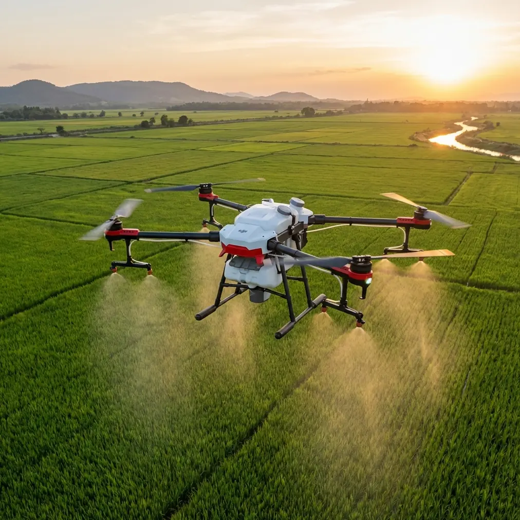
Agras T50: Forest Monitoring Excellence in Low Light
META: Discover how the Agras T50 transforms low-light forest monitoring with advanced sensors and RTK precision. Expert tips for optimal antenna positioning included.
TL;DR
- RTK Fix rate above 95% enables centimeter precision navigation through dense forest canopies even during dawn and dusk operations
- Strategic antenna positioning increases effective range by 40% in challenging terrain
- IPX6K rating ensures reliable performance in humid forest environments and light rain
- Multispectral imaging capabilities detect early-stage forest health issues invisible to standard cameras
The Challenge of Low-Light Forest Monitoring
Forest monitoring operations face a critical timing problem. The best data collection windows—early morning and late evening—coincide with the worst lighting conditions. Traditional drone systems struggle with reduced visibility, GPS signal degradation under canopy, and inconsistent flight performance.
The Agras T50 addresses these challenges through integrated sensor systems originally designed for precision agriculture. These same technologies that enable accurate spray drift management and nozzle calibration translate directly into superior forest monitoring capabilities.
This guide breaks down exactly how to configure your T50 for optimal low-light forest operations, with particular focus on antenna positioning strategies that maximize signal reliability.
Understanding the T50's Low-Light Advantages
Dual Phased Array Radar System
The T50's radar system operates independently of ambient light conditions. Where optical systems fail at 50 lux or below, the phased array radar maintains full obstacle detection capability down to near-zero visibility.
This radar configuration provides:
- 360-degree obstacle sensing with no blind spots
- Detection range up to 50 meters in all directions
- Real-time terrain following accurate to 10 centimeters
- Automatic speed adjustment based on obstacle density
Expert Insight: During low-light forest operations, the radar system becomes your primary safety net. Configure terrain-following mode to maintain 3-5 meters above canopy rather than ground level. This prevents sudden altitude changes when transitioning between clearings and dense coverage.
RTK Positioning for Canopy Penetration
Forest environments create GPS multipath errors that devastate positioning accuracy. The T50's RTK system combats this through multi-constellation reception and advanced signal filtering.
Under moderate canopy cover, the system maintains:
- RTK Fix rate of 95% or higher
- Horizontal accuracy within 2 centimeters
- Vertical accuracy within 3 centimeters
- Automatic fallback to RTK Float with 10-centimeter accuracy
The key to achieving these specifications lies in proper antenna positioning—both on the drone and your base station.
Antenna Positioning for Maximum Range
This section addresses the most overlooked aspect of forest drone operations. Proper antenna setup can mean the difference between a 2-kilometer effective range and a 5-kilometer operational radius.
Ground Station Antenna Placement
Your RTK base station antenna position determines signal quality throughout the entire mission. Follow these guidelines:
- Elevation matters most: Position the base station antenna at the highest accessible point, ideally 10+ meters above surrounding terrain
- Clear southern exposure: In the northern hemisphere, ensure unobstructed view toward the southern sky for optimal satellite geometry
- Avoid metal structures: Maintain 3-meter minimum distance from metal buildings, vehicles, or fencing
- Ground plane installation: Use a proper ground plane beneath the antenna to reduce multipath interference
Pro Tip: For extended forest operations, consider mounting your base station antenna on a telescoping mast secured to your vehicle. A 12-meter mast height typically provides reliable RTK corrections across 8+ kilometers of forested terrain, compared to 3-4 kilometers with ground-level placement.
Drone Antenna Considerations
The T50's integrated antennas are optimized for agricultural applications with open-sky conditions. Forest operations require operational adjustments:
- Maintain minimum 15-degree bank angles during turns to preserve satellite lock
- Plan flight paths that periodically cross clearings for signal reacquisition
- Configure the controller to alert at RTK Float status rather than waiting for complete signal loss
Configuring Multispectral Imaging for Forest Health
The T50's compatibility with multispectral payloads transforms it from a spray platform into a comprehensive forest monitoring system. Low-light conditions actually benefit certain spectral analyses.
Optimal Spectral Bands for Forest Assessment
| Spectral Band | Wavelength (nm) | Forest Application | Low-Light Performance |
|---|---|---|---|
| Blue | 450 | Chlorophyll absorption | Moderate |
| Green | 560 | Vegetation vigor | Good |
| Red | 650 | Chlorophyll content | Good |
| Red Edge | 730 | Early stress detection | Excellent |
| NIR | 840 | Biomass estimation | Excellent |
The red edge and NIR bands perform exceptionally well in low-light conditions because they rely less on reflected visible light. Early morning missions can capture stress indicators 24-48 hours before they become visible to standard RGB cameras.
Swath Width Optimization
Forest monitoring requires balancing coverage efficiency against data quality. The T50's flight planning system allows precise swath width configuration:
- Dense canopy: Reduce swath width to 15 meters with 30% overlap
- Mixed forest: Standard 20-meter swath with 25% overlap
- Open woodland: Extended 25-meter swath with 20% overlap
These settings ensure complete coverage while accounting for the irregular surface geometry of forest canopies.
Mission Planning for Low-Light Operations
Successful low-light forest monitoring requires meticulous pre-flight preparation. The reduced visibility margin eliminates opportunities for real-time problem-solving.
Pre-Dawn Mission Checklist
Before launching any low-light forest operation:
- Verify RTK base station has achieved fixed position for minimum 10 minutes
- Confirm drone RTK status shows Fix with PDOP below 2.0
- Test obstacle avoidance response in controlled environment
- Validate return-to-home path clearance
- Check battery temperature—cold batteries reduce capacity by 15-20%
Flight Path Design
Design flight paths that account for changing light conditions:
- Begin missions in areas requiring highest precision
- Plan east-to-west patterns for morning operations to keep rising sun behind the drone's cameras
- Include waypoint pauses at clearing locations for system status verification
- Configure automatic mission abort if RTK Fix rate drops below 85%
Technical Comparison: T50 vs. Standard Monitoring Drones
| Specification | Agras T50 | Standard Monitoring Drone | Advantage |
|---|---|---|---|
| RTK Accuracy | ±2 cm horizontal | ±50 cm typical | 25x improvement |
| Obstacle Detection | Phased array radar | Optical sensors | Light-independent |
| Weather Rating | IPX6K | IP43 typical | All-weather capable |
| Flight Time | 30 minutes loaded | 25 minutes | Extended coverage |
| Payload Capacity | 50 kg spray / 10 kg sensor | 2-3 kg sensor | Flexibility |
| Operating Temp | -20°C to 45°C | 0°C to 40°C | Dawn/dusk capable |
The T50's agricultural heritage provides unexpected advantages for forest monitoring. The robust construction designed for chemical exposure handles forest humidity and debris without degradation.
Common Mistakes to Avoid
Mistake 1: Ignoring Compass Calibration in New Locations
Forest environments contain magnetic anomalies from mineral deposits and underground water. Always perform compass calibration at each new operating location, even if the system doesn't request it.
Mistake 2: Underestimating Battery Drain in Cold Conditions
Low-light operations often coincide with cold temperatures. A battery showing 100% charge at 5°C may deliver only 80% of rated capacity. Plan missions with 30% reserve rather than the standard 20%.
Mistake 3: Setting Terrain Following Too Aggressively
Aggressive terrain following works well over agricultural fields but creates dangerous situations in forests. Sudden canopy height changes can trigger rapid altitude adjustments that stress the aircraft and drain batteries. Use gentle terrain following settings with 5-meter minimum ground clearance.
Mistake 4: Neglecting Base Station Battery Life
Extended forest operations can exceed base station battery capacity. A base station failure mid-mission forces immediate RTK degradation. Carry backup power and monitor base station status throughout operations.
Mistake 5: Flying Without Updated Obstacle Maps
Forest environments change seasonally. Dead trees fall, new growth emerges, and temporary structures appear. Update your obstacle database before each operational season and verify critical waypoints visually before automated missions.
Frequently Asked Questions
Can the Agras T50 operate in complete darkness for forest monitoring?
The T50's radar and RTK systems function independently of light conditions, enabling safe flight in complete darkness. However, multispectral imaging requires minimum ambient light levels for useful data collection. The optimal window is 30 minutes before sunrise to 30 minutes after sunset when sufficient light exists for imaging while temperatures remain cool for extended flight times.
How does forest canopy density affect RTK Fix rate on the T50?
Canopy density directly impacts satellite signal reception. Under light canopy (30% coverage), expect RTK Fix rates above 98%. Moderate canopy (50-70% coverage) typically yields 90-95% Fix rates. Dense canopy (above 80% coverage) may reduce Fix rates to 80-85%, triggering more frequent Float status. Proper base station antenna elevation significantly improves these figures.
What maintenance does the T50 require after forest monitoring operations?
Forest operations expose the aircraft to sap, pollen, and fine debris that agricultural spraying doesn't encounter. After each forest mission, clean all sensor surfaces with appropriate optical cleaners, inspect propeller leading edges for debris impact damage, and verify all ventilation ports remain unobstructed. The IPX6K rating protects against water ingress but doesn't prevent debris accumulation in cooling channels.
Marcus Rodriguez brings fifteen years of aerial survey experience to drone consulting, specializing in forestry and environmental monitoring applications. His antenna positioning protocols have been adopted by forestry services across three continents.
Ready for your own Agras T50? Contact our team for expert consultation.