Agras T50 Guide: Mastering Construction Site Monitoring
Agras T50 Guide: Mastering Construction Site Monitoring
META: Learn how the Agras T50 transforms construction site monitoring in complex terrain with RTK precision and rugged durability. Expert setup guide inside.
TL;DR
- The Agras T50's centimeter precision RTK system enables accurate progress tracking across challenging construction terrain
- IPX6K rating ensures reliable operation in dust, debris, and adverse weather conditions common on job sites
- Third-party thermal accessories expand capabilities for concrete curing and equipment monitoring
- Proper flight planning reduces survey time by up to 60% compared to traditional ground-based methods
Why Construction Monitoring Demands Specialized Drone Solutions
Construction site monitoring in complex terrain presents unique challenges that consumer drones simply cannot address. Uneven ground, active machinery, dust clouds, and constantly changing landscapes require industrial-grade equipment designed for harsh environments.
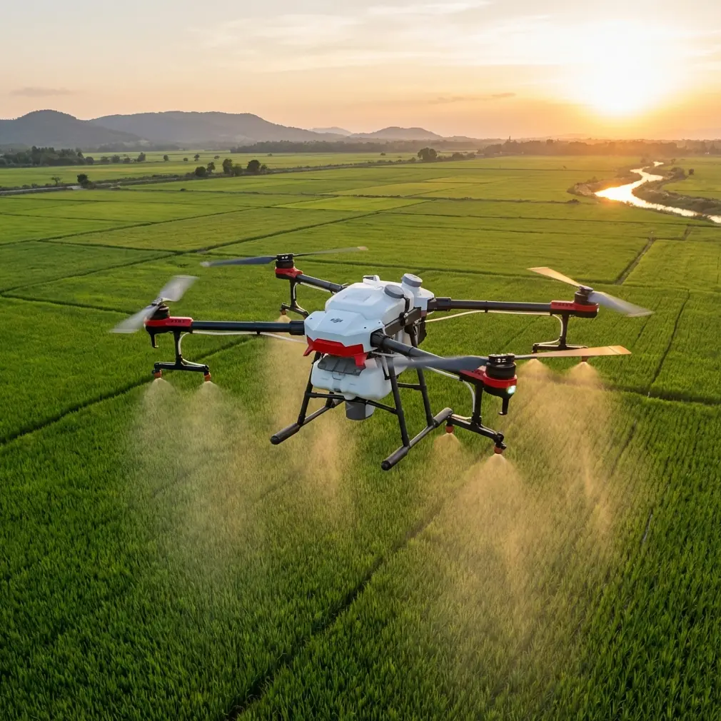
The Agras T50, while primarily engineered for agricultural applications, brings exceptional capabilities to construction monitoring. Its robust build quality, precise positioning systems, and payload flexibility make it surprisingly effective for tracking project progress across difficult terrain.
Traditional surveying methods require crews to navigate hazardous areas, often halting work and creating safety concerns. Aerial monitoring eliminates these risks while delivering more comprehensive data in a fraction of the time.
Understanding the Agras T50's Core Capabilities for Construction
RTK Positioning: The Foundation of Accurate Monitoring
The Agras T50's RTK (Real-Time Kinematic) positioning system delivers centimeter precision that construction professionals depend on. This accuracy level enables:
- Precise volumetric calculations for earthwork progress
- Accurate stockpile measurements
- Reliable comparison between as-built conditions and design specifications
- Consistent data across multiple survey flights
Maintaining a high RTK Fix rate is essential for construction applications. The T50's dual-antenna setup provides heading accuracy of 0.1°, ensuring your measurements remain consistent even in areas with partial signal obstruction.
Expert Insight: Monitor your RTK Fix rate throughout each flight. A rate above 95% indicates reliable positioning data. If rates drop below this threshold near structures or in valleys, consider adjusting your flight altitude or timing.
Rugged Construction for Demanding Environments
Construction sites generate significant dust, debris, and occasionally unexpected precipitation. The Agras T50's IPX6K rating provides protection against high-pressure water jets and fine particulates.
This durability rating means the drone can operate in conditions that would ground lesser aircraft:
- Active excavation areas with airborne dust
- Concrete pouring operations with water spray
- Light rain or morning dew conditions
- High-wind scenarios up to 8 m/s
The folding design also simplifies transport across rough terrain, fitting easily in site vehicles for rapid deployment to multiple monitoring locations.
Step-by-Step: Setting Up Your T50 for Construction Monitoring
Step 1: Pre-Flight Site Assessment
Before launching, conduct a thorough site assessment focusing on:
Obstacle Identification
- Cranes and their swing radius
- Power lines and communication towers
- Temporary structures and scaffolding
- Active equipment zones
Signal Environment
- Identify potential RTK interference sources
- Note areas with limited satellite visibility
- Plan alternative flight paths for challenging zones
Safety Coordination
- Communicate with site supervisors
- Establish no-fly zones around active operations
- Confirm emergency landing locations
Step 2: RTK Base Station Configuration
Proper base station setup directly impacts your data quality. Position your RTK base station on a known survey point or establish a new control point with the following considerations:
- Minimum 15-degree clear sky view in all directions
- Stable mounting surface away from vibration sources
- Clear line of sight to planned flight areas
- Distance from the drone flight path under 5 km for optimal correction signals
Allow the base station 10-15 minutes to achieve stable positioning before beginning operations.
Step 3: Flight Planning for Complex Terrain
Construction sites rarely feature flat, uniform surfaces. Adjust your flight planning to account for terrain variation:
Altitude Considerations
- Maintain consistent height above ground level (AGL) rather than fixed altitude
- Account for stockpiles, excavations, and structures
- Plan for minimum 30-meter clearance above the highest obstacle
Coverage Optimization
- Use 70-80% front overlap for photogrammetry applications
- Increase side overlap to 65-75% in areas with significant elevation change
- Reduce speed in complex areas to ensure image quality
Pro Tip: The T50's terrain-following capabilities, originally designed for agricultural applications, work exceptionally well for maintaining consistent AGL across uneven construction terrain. Enable this feature when surveying areas with significant grade changes.
Step 4: Integrating Third-Party Accessories
The Agras T50's payload flexibility opens opportunities for enhanced monitoring capabilities. One particularly effective addition is the FLIR Vue TZ20 thermal imaging system, which transforms construction monitoring applications.
This thermal accessory enables:
- Concrete curing verification through temperature differential analysis
- Equipment heat signature monitoring for preventive maintenance
- Insulation inspection on completed structures
- Water infiltration detection in foundations and below-grade work
The T50's stable flight characteristics and precise positioning make it an excellent platform for thermal data collection, producing georeferenced thermal maps that integrate seamlessly with construction management software.
Technical Comparison: Agras T50 vs. Common Construction Monitoring Alternatives
| Feature | Agras T50 | Consumer Mapping Drone | Traditional Survey |
|---|---|---|---|
| Positioning Accuracy | ±2 cm (RTK) | ±50 cm (GPS) | ±1 cm (Total Station) |
| Coverage Rate | 12 hectares/hour | 4 hectares/hour | 0.5 hectares/hour |
| Weather Resistance | IPX6K | IPX4 | Operator dependent |
| Wind Tolerance | 8 m/s | 5 m/s | N/A |
| Payload Capacity | 50 kg | 0.5 kg | N/A |
| Setup Time | 15 minutes | 10 minutes | 45+ minutes |
| Terrain Adaptability | Automatic | Manual adjustment | Point-by-point |
The T50's agricultural heritage provides unexpected advantages for construction applications. Its 50 kg payload capacity, while designed for spray tanks, allows mounting of heavy sensor packages that smaller drones cannot support.
Optimizing Data Collection with Proper Calibration
Nozzle Calibration Principles Applied to Sensors
The Agras T50's nozzle calibration system demonstrates DJI's commitment to precision delivery. This same attention to accuracy translates to sensor mounting and calibration for construction applications.
When mounting third-party cameras or sensors:
- Verify gimbal calibration before each flight session
- Check sensor alignment using known reference points
- Confirm focal length settings match your flight altitude
- Validate output against ground control points
Understanding Swath Width for Coverage Planning
The concept of swath width from agricultural applications directly applies to construction monitoring. Calculate your effective coverage width based on:
- Sensor field of view
- Flight altitude
- Required overlap percentage
- Ground sampling distance requirements
For most construction monitoring applications, plan for a ground sampling distance of 2-3 cm/pixel to capture sufficient detail for progress documentation and quantity calculations.
Leveraging Multispectral Capabilities
While multispectral imaging is typically associated with crop health analysis, construction applications exist for sites with environmental monitoring requirements:
- Vegetation health tracking in protected buffer zones
- Erosion monitoring on disturbed slopes
- Revegetation progress documentation
- Wetland mitigation area assessment
The T50's stable platform and precise positioning make it suitable for multispectral sensor integration when projects require environmental compliance documentation.
Common Mistakes to Avoid
Ignoring Magnetic Interference Construction sites contain significant metal structures and equipment that affect compass calibration. Always calibrate away from rebar stockpiles, equipment, and metal buildings. Recalibrate if the drone exhibits unusual behavior.
Underestimating Battery Requirements Complex terrain monitoring requires more hover time and maneuvering than simple grid flights. Plan for 30% additional battery capacity beyond calculated requirements.
Neglecting Ground Control Points Even with RTK positioning, ground control points improve absolute accuracy and provide verification. Establish minimum 5 GCPs distributed across your survey area.
Flying During Active Operations Coordinate with site supervisors to schedule flights during breaks or shift changes. Active equipment creates safety hazards and generates dust that affects image quality.
Overlooking Data Management Construction monitoring generates massive datasets. Establish clear file naming conventions, backup procedures, and storage protocols before beginning regular monitoring flights.
Skipping Pre-Flight Checklists The demanding construction environment accelerates wear on drone components. Implement rigorous pre-flight inspections focusing on propellers, motors, and sensor connections.
Frequently Asked Questions
Can the Agras T50 operate safely near active cranes and equipment?
Yes, with proper planning and coordination. Establish clear communication with equipment operators, define no-fly zones around active machinery, and maintain minimum 50-meter horizontal separation from moving equipment. The T50's obstacle avoidance sensors provide additional safety margin, but should not replace careful flight planning.
How does spray drift prevention technology benefit construction monitoring?
The T50's spray drift management systems demonstrate sophisticated airflow modeling and environmental awareness. These same sensors and algorithms help maintain stable flight in turbulent conditions common around buildings and terrain features, improving image quality and positioning accuracy during construction surveys.
What accuracy can I expect for volumetric calculations?
With proper RTK setup and ground control, expect volumetric accuracy within ±2-3% for stockpile measurements and earthwork quantities. This accuracy level meets requirements for most progress payment verification and quantity tracking applications. For critical measurements, verify results against spot-check traditional surveys.
Maximizing Your Construction Monitoring Investment
The Agras T50 represents a versatile platform that extends well beyond its agricultural origins. Construction professionals who invest time in understanding its capabilities discover a robust, precise, and adaptable monitoring solution.
Success requires commitment to proper procedures, regular calibration, and ongoing coordination with site operations. The investment in training and workflow development pays dividends through improved data quality, reduced survey time, and enhanced safety.
Ready for your own Agras T50? Contact our team for expert consultation.