Agras T50 in Complex Terrain: A Technical Review for Solar
Agras T50 in Complex Terrain: A Technical Review for Solar Farm Mapping Workflows
META: Expert technical review of using the Agras T50 for solar farm mapping in complex terrain, with workflow insights drawn from crop survey, orthomosaic, and hyperspectral field methods.
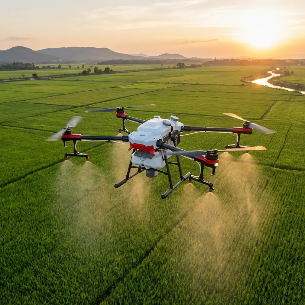
The Agras T50 is usually discussed as an application platform. That is fair, but incomplete. In the field, especially around large solar installations cut into uneven ground, the aircraft becomes something else: a data collection machine that can bridge agricultural drone habits with disciplined geospatial workflow.
That matters because solar farm mapping in complex terrain is not really a “fly and export” task. The hard part is maintaining consistent coverage over slopes, access roads, drainage channels, fence lines, vegetation strips, and irregular panel blocks while still producing usable imagery for measurement, condition review, and site management. If you approach the T50 like a simple farm sprayer, you leave capability on the table. If you approach it like a light survey aircraft with agricultural durability, it starts to make a lot more sense.
I’ve spent enough time around utility sites to know that terrain punishes sloppy assumptions. A map that looks acceptable over flat ground can break down fast when elevation shifts distort overlap, edges soften, and target features lose positional consistency. That is why some of the older crop-survey logic still deserves attention here. A 2016 ArcGIS-based crop investigation workflow broke the job into four practical stages: image acquisition, production of imagery and interpretation sample data, spatial data management, and final industry application. That sequence sounds obvious until you realize how often teams skip steps two and three, then wonder why their outputs are difficult to trust or share.
For an Agras T50 operator mapping solar assets, that four-part logic is still the right backbone.
Why the T50 fits this job better than its label suggests
The T50 is built for harsh outdoor work. That’s a big advantage on solar sites where fine dust, washdown exposure, heat, and long service days are normal. Ruggedness is not just a durability talking point; it directly affects repeatability. A platform that holds up in dirty, repetitive operations is more likely to maintain stable mission behavior, cleaner sensor mounting, and less downtime between collection windows.
In complex terrain, flight consistency is everything. This is where centimeter precision and RTK behavior become operationally significant. A strong RTK fix rate helps preserve line-to-line confidence when you are flying near repeating solar panel geometry, where visual sameness can make alignment errors harder to catch in post-processing. Even small positioning instability can create headaches when the goal is not just pretty imagery, but measurable spatial outputs that support maintenance planning, vegetation control, or drainage review.
The reason I keep stressing precision is simple: solar farms are full of repeating patterns. Repetition is the enemy of lazy mapping. If your dataset is weak, panel rows, roads, inverter pads, and service corridors can blur into each other in the final orthomosaic. If your positioning is strong and your overlap is disciplined, those same features become structured assets that can be indexed, compared, and revisited.
The old crop-survey lesson that solar teams should steal
One of the most useful details in the ArcGIS crop survey reference is the use of consumer-grade multirotor aircraft flying at a defined route and altitude to capture high-definition orthophoto imagery as the base layer for office interpretation. That idea is directly transferable to the T50 in solar work.
The mission is not to collect “some photos.” The mission is to create a consistent orthographic base map that downstream teams can actually interpret. In agriculture, that meant identifying crop type and area. On a solar site, it can mean identifying row alignment issues, vegetation encroachment, erosion signatures, standing water, perimeter condition, or access obstructions.
Another concrete detail from that same source is the sample plot size: 200 meters by 200 meters. That number is useful because it reminds operators to think modularly. On large solar projects in broken terrain, trying to map the whole site in a single mental block usually creates operational drift. Breaking a property into manageable blocks of similar elevation and surface character improves mission setup, overlap discipline, battery planning, and QA. A 200 m × 200 m style segmentation is not a universal rule, but it is a smart planning model when the site includes ridges, benches, retention zones, and scattered infrastructure.
That kind of block-based planning also improves data management. You can isolate weak sectors, rerun problem areas, and maintain cleaner naming conventions for orthomosaics and derivative layers.
Mapping over complex terrain: where workflow beats hardware specs
People love to ask about swath width. It matters, but less than most think for mapping. In application work, wider coverage can be a throughput advantage. In mapping, the better question is whether your flight geometry supports reliable reconstruction over changing elevation.
This is why altitude control strategy matters more than bragging about area covered per hour. On sloped or terraced solar developments, apparent ground sampling and overlap can change quickly if the aircraft is flying a simplistic plan over uneven terrain. If you want usable mosaics, build the mission around terrain response, not flat-earth assumptions.
That discipline echoes the crop survey model again: acquisition comes first, but it only works when it is designed for interpretation. If your final objective is panel-block analysis or vegetation mapping, then your flight lines, sidelap, and trigger behavior should be set for those outputs from the beginning.
The T50’s appeal here is that it combines field toughness with a platform architecture familiar to teams already working around agricultural automation. For contractors who service both rural energy sites and agricultural land, that crossover is useful. The aircraft is not entering an alien workflow; it is extending one.
Where multispectral and hyperspectral thinking enters the picture
Most solar mapping discussions stop at RGB imagery. That is a mistake, especially where vegetation management and drainage behavior affect site performance. This is where the hyperspectral reference becomes more than an academic footnote.
The source makes a strong case that leaf area index, or LAI, is a critical canopy structure parameter and an input for crop growth models and decision-support systems. For solar operators, the exact agronomic model may not be the goal, but the concept absolutely transfers. Vegetation density and vigor around panel rows, fence margins, and stormwater corridors are management variables, not cosmetic ones. Dense growth can obstruct inspection routes, increase maintenance burden, affect shading risk, and conceal erosion or pooling.
The same reference points out that red-band reflectance correlates closely with LAI in several crops, with studies highlighting relationships around 671 nm and 682 nm in rice. It also notes that NDVI combinations such as 760/990, RVI at 760/1001, and DVI at 677/1070 showed strong LAI relationships in corn, while red-edge position, red-edge slope, and red-edge area were highly significant as well.
Why should a T50 operator mapping solar terrain care about those numbers? Because they show that not all vegetation sensing is equal. If you add a third-party multispectral payload or a specialized accessory workflow, you are no longer just coloring the site green and brown. You are potentially building a more sensitive layer for distinguishing stressed vegetation, dense regrowth, moisture-linked growth patterns, and encroachment trends before they become expensive ground problems.
That is the kind of enhancement that changes what the aircraft is worth to a site manager.
I’ve seen teams improve inspection value by integrating a third-party multispectral accessory package rather than relying only on standard visible imagery. The gain is not theoretical. Red-edge-sensitive analysis can reveal vegetation behavior that a normal orthomosaic hides in plain sight. On solar farms with mixed grasses, service tracks, retention zones, and slope transitions, that additional layer can help prioritize maintenance passes and document recurring trouble spots.
Accessory strategy: don’t bolt on complexity without a purpose
The context here mentions a third-party accessory that enhanced capability, and that is exactly how I would frame it: enhancement, not decoration. The best add-ons are the ones that solve a bottleneck in the workflow.
For the T50, that may mean a multispectral payload integration, a more stable custom sensor mount, or a field kit that speeds calibration and repeatability between sorties. If the mission includes vegetation diagnostics near panel arrays, multispectral is the obvious candidate. If the mission includes repeated corridor mapping after rain events, then mounting stability and georeferencing discipline may matter even more.
The trap is adding sensor complexity without strengthening your data chain. Remember the ArcGIS workflow: acquisition, production, management, application. If you upgrade the front end but ignore the middle, you just create heavier files and weaker decisions.
For teams trying to build that pipeline properly, a practical way to compare mounting options and workflow integrations is to message a field integration specialist here. The value is not in getting more hardware. The value is in avoiding a payload setup that disrupts balance, calibration routine, or data consistency.
A word on nozzle calibration, spray drift, and why they still matter in this conversation
At first glance, nozzle calibration and spray drift sound irrelevant to solar farm mapping. They are not. They reveal how the T50 should be handled.
An aircraft designed for precise agricultural delivery trains operators to think in terms of route discipline, output consistency, edge effects, and environmental variability. Those habits transfer well into mapping. A pilot who understands how wind and spacing affect drift already has the right instincts for image overlap degradation and motion inconsistency. A team used to nozzle calibration tends to respect calibration in general, which is exactly the attitude you want when working with RTK, camera alignment, and multispectral normalization.
So while the mission here is civilian mapping rather than spraying, the operational mindset built around agricultural precision is still a strength. The T50 rewards crews that treat repeatability as a system, not a checkbox.
Data products that actually help solar operations
The most useful output from a T50 mapping mission is usually not a raw image set. It is a structured package.
At minimum, that means:
- a high-definition orthomosaic for visual review,
- georeferenced block or corridor layers for asset context,
- a managed archive that supports repeat comparison,
- and, where sensors allow, vegetation or surface-condition layers tied to maintenance decisions.
Again, this tracks closely with the crop investigation reference, where imagery was not the endpoint. The endpoint was interpretation, statistics, and management application. In solar terms, the same logic supports vegetation control planning, drainage monitoring, perimeter management, and change detection.
That is the operational significance of grounding the T50 in a real geospatial workflow rather than treating it as a generic UAV. The aircraft may fly the mission, but the system delivers the result.
Security pressure is part of the operating environment now
One final point deserves attention. A 2021 industry reference on counter-drone technology noted how drone safety became a hot topic as drone numbers kept rising, and cited an FAA figure showing 600,000 registered or recorded drones in the United States back in 2016. That statistic is old, but the implication is current: any professional drone operation today exists in a more crowded, more scrutinized airspace environment than the industry once did.
For solar farm mapping, this affects planning in a practical way. Large infrastructure sites are sensitive to unauthorized overflight, and stakeholders increasingly care about who is flying, why they are flying, and how the activity is documented. A T50 mission at a utility-scale site should therefore be managed with clear flight authorization, site coordination, mission logs, and controlled data handling. Good mapping is no longer just about image quality. It is also about operational legitimacy.
That broader safety context is easy to ignore until it delays a project.
Final assessment
The Agras T50 is not the first aircraft many people would name for solar farm mapping, and that is exactly why it deserves a closer technical review. In complex terrain, the platform can be surprisingly effective when paired with a disciplined orthomosaic workflow, strong RTK performance, and a clear data-management plan. The old crop-survey model of acquisition, production, management, and application still holds up. So does the remote-sensing lesson that red, red-edge, and related vegetation indices can reveal more than standard imagery when site management depends on understanding growth patterns.
Used carelessly, the T50 is just a rugged drone doing extra work. Used well, it becomes a field-ready mapping platform with crossover value that many teams overlook.
Ready for your own Agras T50? Contact our team for expert consultation.