Agras T50 Mapping Tips for Windy Forest Conditions
Agras T50 Mapping Tips for Windy Forest Conditions
META: Expert Agras T50 guidance for mapping forests in windy conditions, with practical flight altitude, RTK, drift control, and calibration advice.
Forest mapping in the wind is where a lot of drone plans fall apart. On paper, the mission looks straightforward: define the boundary, set overlap, launch, collect data, go home. In the field, tree canopies create turbulence, slope changes alter wind behavior by the minute, and GPS quality can shift as trunks and terrain start blocking parts of the sky. If you are flying an Agras T50 around forests in breezy conditions, the question is not simply whether it can fly the route. The real question is whether the data will still be usable when the mission is over.
That distinction matters.
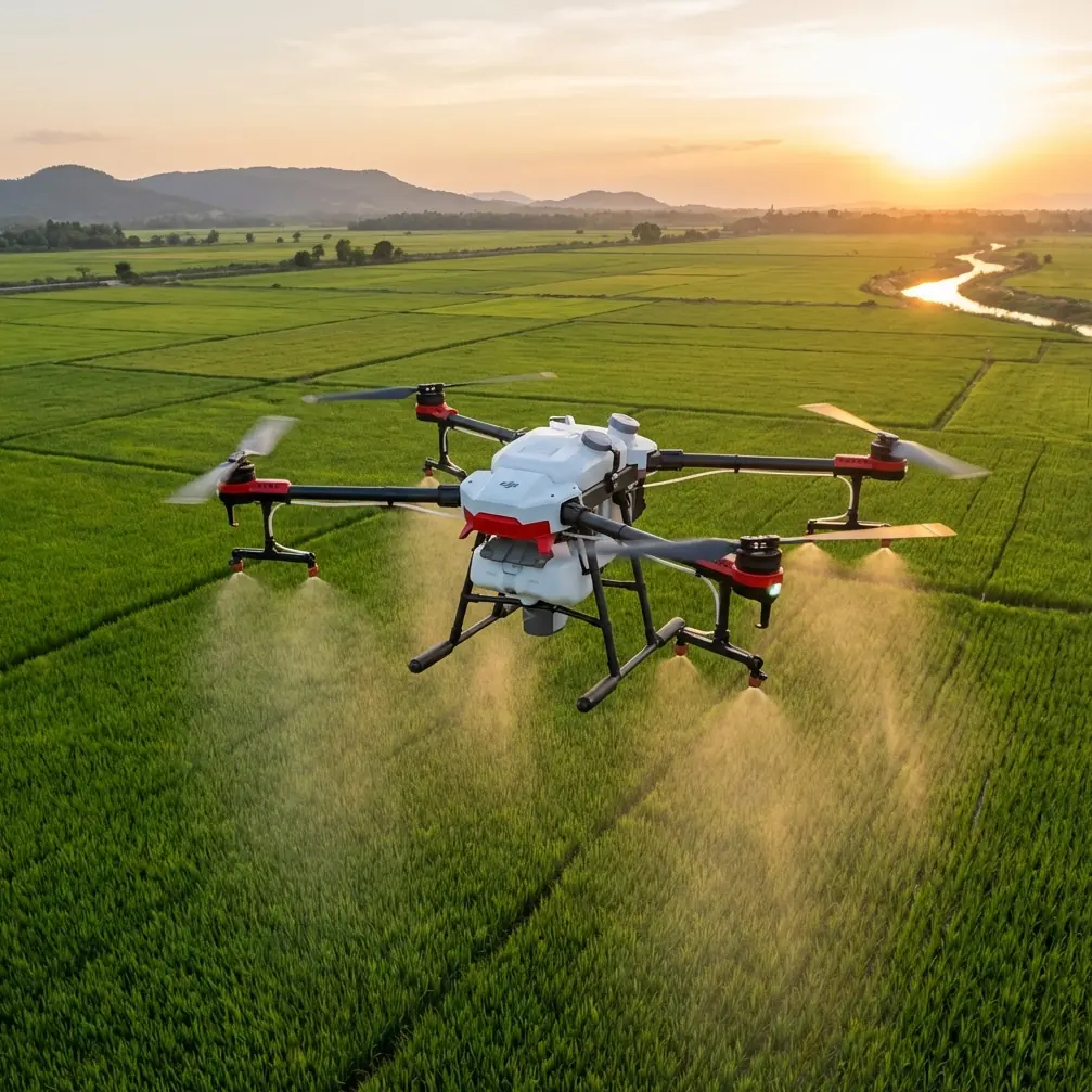
The Agras T50 is often discussed through the lens of spraying and spreading, but operators working near forestry blocks, shelterbelts, timber edges, or mixed agricultural land quickly learn that its field hardware, positioning stack, and weather-oriented build can also shape how well it performs on data-sensitive missions around trees. Wind exposes every weakness in setup discipline. It punishes poor nozzle calibration if liquid is onboard, reduces confidence in swath consistency, and can make a weak RTK fix rate show up as visible alignment errors in the final map.
For a forest mapping job, especially in windy conditions, the biggest mistake is flying too high in the hope of smoothing out the route. That instinct sounds logical, but in tree-rich terrain it often works against you. Higher altitude can place the aircraft in cleaner, stronger wind above the canopy where lateral drift becomes more pronounced. The better starting point is usually to fly just high enough above the tallest canopy to maintain safe obstacle clearance while limiting exposure to the stronger airflow aloft. In practical terms, a controlled working height around 20 to 30 feet above the top of the canopy is often the sweet spot for this scenario, assuming local regulations, terrain relief, and obstacle margins allow it.
Why does that altitude band work so often?
Because forest wind is layered. At canopy level, the air is messy and turbulent, but there is also some shielding effect from the trees themselves. Climb too far above that zone and the aircraft can enter a faster, more uniform crosswind that steadily pushes the platform off track. For mapping, steady push is not harmless. It affects line keeping, overlap reliability, and any effort to maintain centimeter precision across repeated passes. The T50’s control system can compensate for a lot, but there is a difference between an aircraft that remains stable and a dataset that remains accurate enough to trust.
That is where RTK fix rate becomes more than a spec-sheet talking point. In open farmland, operators can get away with sloppy attention to satellite geometry or base station placement because the environment is forgiving. Forest edges are less forgiving. Canopy proximity, trunks, ridgelines, and even moisture-heavy foliage can degrade the consistency of the RTK solution. If the fix drops intermittently, the aircraft may still complete the mission, but stitching and positional confidence can suffer. For anyone trying to build a reliable forest-edge orthomosaic or track stand changes over time, that is a real operational problem, not a cosmetic one.
With the T50, the goal is not simply to see RTK engaged at takeoff. The goal is to sustain a strong RTK fix rate throughout the mission. That means placing the base or correction source where it has a clean view of the sky, away from tall trunks, steel structures, and terrain shadows. It also means resisting the temptation to launch from the most convenient forest opening if that opening compromises satellite visibility. In windy conditions, you are already asking the aircraft to work harder on stability. You do not want the positioning system fighting a second battle at the same time.
Another point that deserves more attention in forest mapping is swath width, even when the mission is not a pure spray run. Operators familiar with the Agras series tend to think in terms of application width because that is how these aircraft are often deployed. But the same thinking helps on mapping-oriented work near forests: every pass width assumption must reflect what the aircraft can realistically hold in wind, not what looks efficient in calm weather. A wide swath on a breezy day can leave you with inconsistent coverage and edge distortion, especially when turbulence rolls off uneven canopy heights. Tightening the effective pass plan is often the smarter choice, even if it adds a few minutes to the mission.
That tradeoff is even more important if the job is a hybrid one, where the T50 is mapping conditions before or after treatment. In those cases, spray drift is not just a compliance concern. It becomes part of the data quality problem. Drift can move droplets into adjacent vegetation bands, blur treatment boundaries, and create misleading visual signatures in the imagery if you are evaluating canopy response or application uniformity afterward. Windy forests amplify this effect because air currents bend around trunks and open lanes in unpredictable ways. If liquid is involved, nozzle calibration is no longer routine maintenance. It is mission protection.
A well-calibrated nozzle setup helps ensure that output, droplet behavior, and coverage expectations match the actual flight environment. In calm fields, a small calibration error may be hidden by broad, even application. Along forest margins, it shows up quickly. You may see heavier deposition on the downwind edge, lighter coverage on the upwind side, and inconsistent penetration where canopy height changes sharply. That matters whether your end goal is agronomic treatment, vegetation monitoring, or documenting a forest-adjacent block with confidence. The aircraft can only execute well if the delivery system is tuned to the conditions.
This is one reason the T50’s more rugged field design matters in real forestry-adjacent work. An IPX6K rating is not a marketing ornament when you are operating around moisture, mud, residue, and repeated clean-downs after missions in harsh environments. Forest work is rarely clean. Wet leaves, fine debris, and dirty access tracks become part of the job. A platform that tolerates aggressive washdown and rougher field handling reduces downtime and helps maintain operational readiness between missions. That does not directly improve map accuracy, but it absolutely affects whether crews can sustain disciplined operations over a long workday in changing weather.
The same practical mindset applies if you are integrating multispectral workflows into the broader decision process. The T50 is not usually the first airframe people mention when they talk about multispectral analysis, but many forestry and land managers are not operating in neat single-purpose silos. They are trying to understand tree health, boundary encroachment, moisture stress, drainage issues, and treatment effectiveness across mixed-use ground. If your workflow includes multispectral interpretation from another platform, the T50’s role often becomes the operational bridge between what the data suggests and what the crew actually does in the field. In windy forest conditions, that bridge only works if your positional repeatability is strong and your flight profiles are consistent enough to compare one mission against another.
That brings us back to flight altitude, because altitude decisions ripple through everything else. If you launch a windy forest mission too high, you usually pay in drift, overlap inconsistency, and positional confidence. If you fly too low, you increase the risk of turbulence-induced instability, branch conflicts, and abrupt terrain surprises. The best operators treat altitude as a canopy-relative variable, not a generic mission setting. They walk the site, identify the tallest trees, note openings where wind accelerates, and then set a height that preserves both safety and control. Again, roughly 20 to 30 feet above the canopy is a strong operational starting point, but not a universal rule. Dense conifers on rolling ground behave differently from mixed hardwoods with irregular crowns and open lanes.
A useful way to think about it is this: your mission altitude should be low enough to reduce exposure to stronger crosswinds above the canopy, but high enough to prevent sudden obstacle conflicts when the aircraft encounters lift, sink, or gust-driven side motion. If you can maintain that balance while preserving a strong RTK fix rate, you are already ahead of many crews that approach the job with a flat-field mindset.
There are also workflow habits that separate clean forest mapping runs from frustrating ones. One is splitting large missions into smaller blocks. In the wind, a smaller block lets you monitor drift trends, RTK behavior, and coverage quality before committing the aircraft to a long route over difficult terrain. Another is orienting flight lines with the actual wind pattern rather than the easiest property boundary. In forest environments, the wind you feel at takeoff is often not the wind the aircraft sees halfway down the route. Watching treetops before launch tells you more than looking at a general weather app.
It also helps to set realistic expectations for data perfection. Forest mapping is inherently harder than open-field mapping because canopy geometry introduces texture, shadow, and visual variability that challenge even well-flown missions. The T50 can handle demanding field conditions, but good outcomes still depend on operator judgment. Stable flight does not automatically mean high-confidence geospatial output. The discipline comes from linking aircraft behavior, RTK reliability, pass planning, altitude, and environmental reading into one coherent method.
If you are refining your own windy-forest workflow and want a second opinion on setup logic, mission planning, or drift control, this quick field consultation channel is a practical place to compare notes.
The larger lesson is simple: windy forest mapping is not won by brute force. It is won by reducing variables. Keep the aircraft close enough to the canopy to avoid the stronger wind layer overhead. Protect your RTK fix rate so centimeter precision is not just theoretical. Treat swath width as a control variable, not a speed target. Calibrate nozzles carefully if the mission includes liquid operations, because spray drift near trees can compromise both application quality and downstream interpretation. Use the T50’s rugged, IPX6K-ready design as an operational advantage, not an excuse to be casual with mission discipline.
That approach is what turns the Agras T50 from a capable aircraft into a dependable forestry-edge tool. Not because it ignores the wind, but because it is flown in a way that respects what the wind is doing to the mission.
Ready for your own Agras T50? Contact our team for expert consultation.