Agras T50 in Windy Field Inspection: A Practical Field
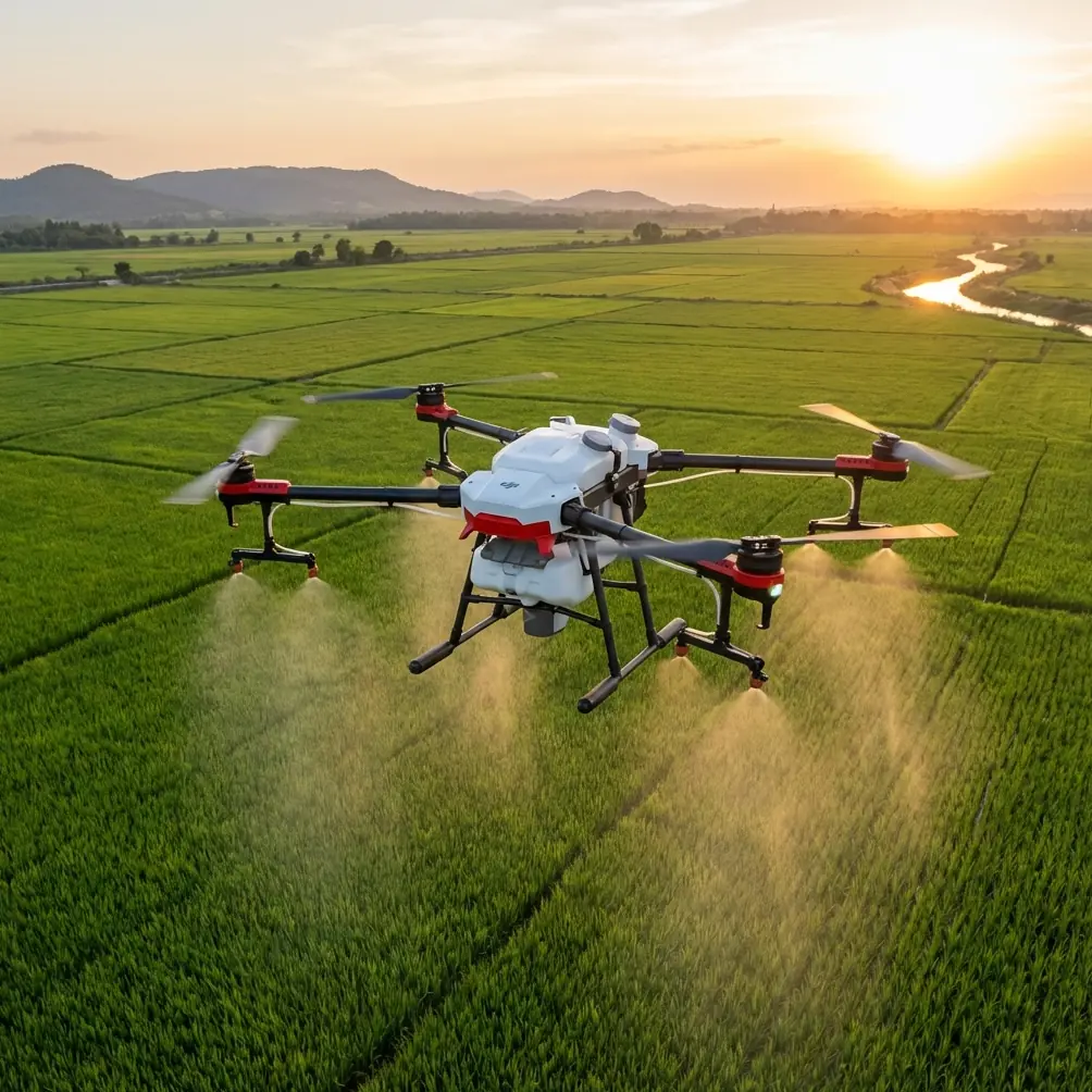
Agras T50 in Windy Field Inspection: A Practical Field Report on Connectivity, Verification, and Clean Pre-Flight Discipline
META: A field-based expert article on using the Agras T50 for windy agricultural inspection, with practical insight on temporary aerial communications, image verification, RTK-grounded accuracy, and pre-flight cleaning discipline.
Wind changes the whole logic of a field day.
On calm mornings, an inspection workflow can feel almost routine: check the aircraft, confirm the mission boundary, launch, review imagery, move on. In windy conditions, that rhythm breaks. Coverage edges become harder to trust. Fine details can hide behind motion, crop movement, or simple operator hesitation. Even something as basic as maintaining reliable communications across a large property becomes more consequential, because the aircraft is no longer just following a neat plan on paper. It is working inside a changing environment.
That is where the Agras T50 becomes interesting—not as a brochure subject, but as a platform that sits in the middle of several real field disciplines at once: aviation, agronomy, image interpretation, positioning, and communication resilience.
This report focuses on one practical question: how should an operator think about field inspection with the T50 when wind is part of the day rather than an exception?
The first mistake: treating inspection as separate from communications
Many operators still talk about “the flight” and “the data” as if connectivity is just a convenience layered on top. In real agricultural work, especially over fragmented or remote plots, communication architecture can decide whether an inspection is merely flown or actually usable.
One of the more revealing reference points comes from the recent Digital China Construction Summit, where China Unicom showed a low-altitude ad hoc networking system designed for low-altitude operations. The operational point is straightforward and highly relevant: the system does not rely on ground base stations, and once carried aloft by a drone, it can rapidly form a temporary communication network in the air.
That matters far beyond emergency response. For an Agras T50 crew inspecting fields in windy conditions, temporary airborne communication capacity changes the risk profile of the operation. If the terrain, vegetation, or farm layout creates weak coverage zones, a low-altitude self-organizing network offers a way to sustain data flow and coordination without depending entirely on terrestrial infrastructure. In practical terms, that can support more reliable transmission of flight status, field notes, task updates, and image review workflows when the normal network is patchy.
Wind raises the value of this kind of redundancy. When air conditions are less forgiving, you want fewer unknowns, not more. If communication drops out at the same time you are trying to assess drift exposure, crop stand irregularity, or lodging patterns, the inspection slows down and decisions lose confidence.
The T50 is often discussed for treatment efficiency, but the inspection side deserves equal attention. A good windy-day workflow is not just about whether the aircraft can fly. It is about whether the whole team can still verify what they are seeing in time to act on it.
Why image verification matters more than people admit
There is a persistent habit in agriculture tech to confuse image collection with field understanding. They are not the same thing.
A useful clue appears in the ArcGIS field-to-office integration example. In that workflow, an operator can click an interpreted sample point using an HTML popup in ArcMap, open the thumbnail, and then view the original high-resolution image. In the cited case, checking the source image made it possible to confirm that plot 69 was planted with corn.
That sounds simple. It is not.
The significance is that interpretation was not left at the abstract map layer. The analyst could move back to the raw image and verify the agronomic reality. For Agras T50 inspection work, especially in wind, this is the difference between assumption and evidence.
If a field edge appears uneven in overview imagery, is that a crop issue, wind movement artifact, or a perspective distortion from the flight pass? If a canopy patch looks sparse, are you seeing true stand loss, mixed planting, or just directional leaf movement during capture? The answer often sits in the original frame, not the summary map.
A disciplined T50 operator should build this verification loop into every serious inspection cycle:
- collect spatially coherent field imagery,
- tie observations to mapped sample points or plots,
- reopen the original high-resolution frames before making agronomic judgments.
The plot-69 example matters because it demonstrates a professional habit: never trust a generalized interpretation more than the underlying source evidence. In windy conditions, that habit becomes essential. Wind introduces ambiguity. Original imagery removes some of it.
The quiet role of RTK logic in inspection credibility
When growers or managers ask whether an inspection result is reliable, they rarely phrase it as a geospatial question. They ask whether the map is “right,” whether the issue is “actually there,” or whether the aircraft “hit the same area” as before. Underneath all of those questions is positional consistency.
The forest remote-sensing reference offers a useful benchmark for thinking about this. In that case, a 0.5 m WorldView satellite image was used as a reference, 17 RTK ground control points were collected for geometric correction, and then 30 image control points were used to correct the stitched drone imagery to 0.2 m spatial resolution.
Even though that study comes from forest resource investigation rather than row-crop spraying, its operational lesson transfers cleanly to Agras T50 inspection. Precision is not just a matter of onboard positioning claims. It is earned through a chain of reference, correction, and verification. The numbers matter. Using 17 RTK-derived control points to correct the base reference and 30 more points to align the drone mosaic is not a decorative technical detail. It shows that useful aerial interpretation depends on disciplined spatial anchoring.
For a windy agricultural inspection, this has two immediate consequences.
First, RTK fix rate is not a vanity metric. It underpins your ability to return to the same trouble spot, compare crop condition over time, and separate real agronomic change from mapping inconsistency.
Second, centimeter-level confidence is only meaningful when the field workflow respects it. If a team rushes from launch to visual impression without tying observations back to a stable geospatial framework, the quality ceiling drops fast.
An Agras T50 operator who understands this will think beyond the flight path. They will ask: do I have sufficient positional confidence to revisit that suspect strip tomorrow? Can I align today’s visual findings with prior treatment zones? If wind pushed the timing and altered the inspection sequence, do I still trust the location references enough to compare passes?
That is what professional inspection looks like. Not just collecting data, but defending it.
Pre-flight cleaning is not cosmetic on a windy day
The least glamorous step before launch is often the one that prevents the most avoidable problems.
If you are preparing an Agras T50 for field inspection in wind, start with cleaning. Not casually. Methodically. This is especially relevant when the same aircraft operates across spray, spread, and observation tasks.
Residue around nozzles, frame recesses, landing gear junctions, sensor windows, and payload interfaces does more than make the machine look used. It can interfere with safety checks, distort operator confidence, and complicate interpretation during low-altitude work. If you are also evaluating spray drift risk or planning a later treatment run, nozzle calibration and nozzle cleanliness belong in the same conversation as route planning.
The practical sequence I recommend is simple:
- rinse or wipe away visible chemical or dust residue from exposed surfaces,
- inspect nozzle outlets and surrounding components for blockage or buildup,
- clean downward and forward-facing sensing areas carefully,
- check landing gear and arm joints for debris that may affect movement or post-flight inspection,
- confirm that camera or imaging surfaces are clear before the aircraft ever leaves the ground.
The reason this matters in wind is subtle. Wind already adds uncertainty. A dirty sensor, partially fouled nozzle assembly, or residue film on an optical surface adds another layer of ambiguity that the operator may mistakenly blame on conditions. Clean systems produce cleaner decisions.
If your T50 platform is being used in mixed operations, this pre-flight cleaning step is also a safety boundary between yesterday’s chemical work and today’s inspection work. That separation should be treated as a professional standard, not an optional extra.
Windy inspection is really about decision confidence
A lot of discussion around agricultural drones gets trapped at the aircraft level: payload, speed, swath width, ingress protection, endurance. Those all matter. On the T50, they matter a great deal in actual farm operations. But for inspection in wind, the deeper issue is decision confidence.
Can you trust the communication path if the field is poorly served by terrestrial infrastructure? The low-altitude ad hoc networking example suggests one strong answer: airborne temporary communications can reduce dependence on ground base stations and keep teams connected when the operating environment is less than ideal.
Can you trust what the imagery seems to show? The ArcGIS sample-point example answers that too: only if you are prepared to open the original high-resolution image and verify the interpretation. The fact that plot 69 could be confirmed as corn from the original frame is not just a software trick. It is a model for how inspection should be done.
Can you trust the geometry of what you mapped? The forest investigation reference gives a disciplined framework: 17 RTK-derived ground control points for correction, 30 control points for drone image adjustment, and a final 0.2 m spatial resolution. That is the anatomy of defendable aerial observation.
Taken together, these references point to a better way to think about the Agras T50. Not simply as a field machine, but as the center of a connected evidence workflow.
What this looks like in the field
Here is how I would structure a windy-day T50 inspection assignment on a real farm:
1. Clean before you configure
Do the pre-flight cleaning first, especially around nozzles, sensor surfaces, and attachment points. If drift sensitivity is part of the day’s concern, nozzle calibration status should be reviewed before any later spray decisions are made.
2. Confirm your positional discipline
Check RTK readiness and make sure the planned observation zones align with known field boundaries or previous task layers. If comparison over time matters, this step cannot be rushed.
3. Plan for communications, not just flight
If the area is known for weak network performance, think in terms of low-altitude connectivity resilience. An airborne temporary network architecture that does not depend on ground base stations can have real operational value in rural or obstructed environments.
4. Collect imagery with verification in mind
Do not gather images just to create a broad mosaic. Capture in a way that allows you to revisit specific points and inspect the original frames later.
5. Validate interpretations against source imagery
If a plot looks stressed, uneven, lodged, or patchy, open the original high-resolution image. The plot-69 example from the ArcGIS workflow is the right lesson: when needed, go back to the raw frame and identify what is actually planted or actually happening.
6. Separate wind effect from agronomic effect
This is where experience matters most. Wind can mimic crop irregularity in imagery and can also expose real issues faster in the field. Your job is not to react to every visual anomaly. Your job is to test what the anomaly means.
A final professional view on the T50
The Agras T50 deserves to be evaluated in context, not isolation.
Its real value in inspection work emerges when three standards are held together: clean and disciplined pre-flight preparation, geospatial credibility grounded in RTK-aware workflows, and communication resilience that does not collapse when rural infrastructure becomes the weakest link. Add a verification culture that checks original imagery before drawing conclusions, and the aircraft becomes far more than a platform that simply flies over crops.
That is the difference between operating a drone and running an aerial evidence system.
If your team is refining T50 inspection workflows for windy conditions and wants to compare notes on communications architecture, image verification, or field setup discipline, you can start the discussion here: message our field team directly
Ready for your own Agras T50? Contact our team for expert consultation.