Agras T50 at High Altitude Construction Sites
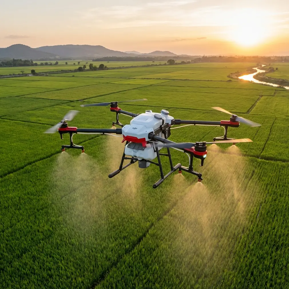
Agras T50 at High Altitude Construction Sites: A Practical Inspection Playbook
META: Expert guide to using the Agras T50 for high-altitude construction site inspection, with field-focused advice on deformation monitoring, operator compliance, and antenna positioning for better range.
Most people approach the Agras T50 from the agriculture side first. That makes sense. It is known as a plant protection platform. But in the field, especially around difficult construction environments at altitude, the more interesting question is not what category it came from. The question is whether it can help teams observe what matters, safely and repeatedly, when the ground is unstable, access is poor, and conventional measurement methods start to show their limits.
That is where this conversation becomes useful.
For high-altitude construction inspection, the real challenge is rarely just “getting a drone in the air.” The harder part is obtaining reliable visual evidence over time, in a way that supports engineering judgment. You need repeatable vantage points. You need coverage over large structures. You need to detect whether a condition is changing, not just whether something exists in a single snapshot. And if you are operating in remote mountain work zones, hydropower corridors, steep slopes, or large structural sites, you also need procedures that respect pilot management rules and communication discipline.
The Agras T50 enters that picture in a non-obvious but very practical way.
Why the inspection problem gets harder at elevation
High-altitude construction sites punish weak workflows. Roads are narrower. Wind behavior changes quickly around cuts, retaining walls, steel frames, and unfinished concrete masses. Human spot checks take longer and expose staff to more risk. Traditional point-based measurement methods can also become awkward when what you really need is area-wide condition awareness.
One of the strongest ideas from engineering UAV practice is that drone-based digital photogrammetric measurement is valuable not just for imagery, but for full-process observation of material and structural deformation. That matters because deformation is often the earliest useful signal in construction risk.
The engineering reference material is explicit on this point. It highlights drone-based monitoring for deformation evolution in materials and structures as an advanced technique for deformation measurement and feature recognition. In practical terms, that means a UAV is not merely taking pretty site photos. It can support a monitoring method that helps teams compare conditions over time and identify whether settlement, tilt, displacement, or cracking is developing.
That distinction is operationally significant.
If a high-rise, large factory foundation, steel structure, or vibration-prone production building begins to show uneven settlement or displacement, the issue is not just that a defect exists. The issue is that the defect may be evolving. A platform like the Agras T50 becomes useful when it is treated as part of a repeatable inspection system: same mission geometry, stable image capture, consistent antenna setup, disciplined pilot operation, and structured data comparison.
The best use case is not generic “inspection”
For high-altitude construction work, the Agras T50 is most valuable when used for targeted observation problems such as:
- slope and edge condition checks near hydropower or mountain projects
- broad visual review of steel structure deformation zones
- repeated observation of suspected settlement areas
- crack progression checks on bridge-related or elevated structural components
- remote viewing of hard-to-reach construction sections
This is closely aligned with the engineering document’s examples. It points to drone support for remote earth dam deformation, caisson construction monitoring, surface subsidence measurement in mining zones, tunnel collapse monitoring, bridge crack and structural displacement observation, steel structure deformation measurement, hydropower dam foundation review, slope faults and weak planes, and general building deformation monitoring.
That list matters because it reframes the T50’s role. Instead of asking whether the aircraft was originally designed for agricultural work, the better question is whether its flight stability, payload flexibility, route discipline, and field durability can support site teams that need safer access to difficult visual data.
On remote mountain jobs, the answer can be yes, if the mission is designed properly.
A high-altitude problem-solution approach
Problem 1: The site is too large for point checks, but too risky for frequent close access
Conventional point measurement has a natural limitation: it tells you what is happening at a few points, not necessarily across the full surface condition of a structure. The engineering source makes this criticism directly, noting that UAV-based digital photogrammetric measurement addresses the inherent limitation of traditional electrical point measurement methods.
Why is that important for an Agras T50 operator?
Because construction defects do not always announce themselves exactly where crews expect them. On a bridge deck, roof truss, retaining face, or elevated support zone, a localized point check may miss broader deformation patterns. A drone mission that captures structured visual coverage can reveal whether the issue is isolated or part of a larger movement trend.
For a high-altitude site, this means the T50 should not be flown as an improvisational camera platform. It should be used with preplanned passes, consistent standoff distance, and overlap logic that supports comparison between flights. If you are trying to identify displacement or crack progression, repeatability beats spontaneity every time.
Problem 2: Range and signal discipline degrade in complex terrain
Mountain construction sites are notorious for signal complications. Cut slopes, machinery, scaffolding, steel assemblies, power infrastructure, and terrain shadowing all interfere with clean control and data links. That is why antenna positioning deserves more respect than it usually gets.
A simple field rule: do not point the tip of the antenna directly at the aircraft if the system is designed to radiate more effectively broadside. Keep the controller antenna faces oriented toward the drone’s flight area, maintain line of sight where possible, and avoid standing immediately beside steel containers, rebar cages, parked heavy equipment, or temporary site offices built from metal panels. Even a capable aircraft can feel unreliable if the ground setup is poor.
At high altitude, I also advise crews to choose a pilot position based on geometry, not convenience. The best place to stand is often not the nearest edge of the work zone. It is the place with the cleanest propagation path into the mission box. A slight elevation change or a move of 20 to 30 meters can make a meaningful difference in link stability.
If your team needs help mapping a cleaner control position for a difficult site, send the mission environment details through this field support chat.
And this is where RTK Fix rate enters the conversation. People throw around “centimeter precision” as if it appears automatically. It does not. A dependable RTK Fix rate relies on a healthy chain: strong satellite visibility, stable correction flow, limited interference, and disciplined setup. In a narrow valley or near tall structural masses, geometry can work against you. If the fix is unstable, your repeatability suffers, and repeatability is the backbone of meaningful comparison.
Problem 3: High-value data is useless if the operator framework is weak
This is the part many site teams try to skip. They should not.
The Chinese civil aviation advisory circular AC-61-FS-2016-20R1 makes a broad but very relevant point: as civil unmanned aircraft use has expanded, pilot management has had to become more structured to support healthy development of the industry. That sounds administrative, but in construction inspection it has direct consequences.
The document also identifies a dedicated Class V category for plant protection UAVs, while other classes are grouped by weight ranges such as Class III at 4<W≤15 kilograms empty weight and Class IV at 15<W≤116 kilograms empty weight. The operational significance is straightforward: classification affects the expectations around pilot qualification and management. For a site using an Agras platform outside casual farm conditions and in a demanding industrial environment, pilot competency is not a paperwork side issue. It is risk control.
A high-altitude construction inspection mission asks more of the operator than a short open-field task. The pilot must manage terrain, route discipline, safe separation from structures, weather shifts, and data consistency. A well-trained operator is more likely to notice when the mission conditions no longer support valid comparison data. That protects both flight safety and engineering usefulness.
What the Agras T50 does well in this role
The T50 makes sense when the inspection need has three characteristics:
- The area is difficult to access on foot
- The observation needs to be repeated over time
- The site team values broad visual coverage over single-point readings alone
That third point is worth stressing. The engineering source emphasizes the advantage of UAV visual and digital imaging methods for wide-area, flexible monitoring. It even describes using visual technology and two point-cloud datasets to compare whether a steel roof structure had deformed. That is a smart model for T50-led site practice: gather consistent visual datasets that can be compared over time, rather than treating each flight as a standalone event.
If your workflow includes RTK-supported positioning, repeatable route planning, and disciplined image collection, the aircraft can support a practical monitoring loop:
- baseline capture
- interval recapture
- side-by-side review
- anomaly escalation for engineering follow-up
That is how drone inspection becomes operationally credible.
Best practices for high-altitude T50 inspection missions
1. Start with one defect hypothesis, not a vague survey goal
Do not launch with “let’s see what we find.” Choose a specific question:
- Is the slope face changing?
- Is the steel frame showing displacement?
- Are cracks widening near a support zone?
- Is settlement visible around the foundation perimeter?
A clear hypothesis shapes route altitude, standoff distance, image angle, and revisit interval.
2. Build repeatability into every flight
If the first flight is ad hoc, the second flight cannot be meaningfully compared. Use the same launch area when safe, similar flight geometry, and a documented antenna orientation. If RTK is part of the workflow, verify the fix quality before you start collecting comparison data.
Centimeter precision is only useful if the mission itself is repeatable enough to leverage it.
3. Treat antenna placement as part of the mission plan
This is the most overlooked range advice I give. Maximum range is not just about transmission power. It is about alignment and environment.
For better range and cleaner control:
- face the antenna broadside toward the operation area
- keep the controller above waist level when possible
- avoid metal clutter behind or around the controller
- do not stand downhill if moving uphill gives a clearer line to the aircraft
- recheck orientation before each leg if the aircraft changes sector significantly
This is especially important in mountain construction sites, where terrain shielding can create misleading dead zones.
4. Separate inspection objectives from agricultural assumptions
Terms like spray drift, nozzle calibration, and swath width belong to agricultural task planning. They may still be familiar to T50 users, but for construction inspection they should not dominate your thinking. In this context, route spacing and image geometry matter more than spray pattern logic. The aircraft may come from a crop protection lineage, but your inspection workflow should be built around structural visibility, not field application habits.
5. Use durability wisely, not recklessly
A rugged platform helps in dirty, wet, and variable environments. If your operation references weather resistance expectations such as IPX6K-class thinking for equipment selection, that supports resilience in harsh field conditions. But resilience is not permission to fly in every condition the mountain throws at you. Rain, mist, rotor wash around loose dust, and gusts near steel edges still degrade image quality and safety margins.
6. Escalate anomalies to engineers early
Drone inspection is excellent at showing where to look harder. It does not replace structural judgment. If repeated flights suggest growing displacement, fresh cracking, or changing surface behavior, the right next step is engineering review, not more casual flying.
Where the T50 fits best in a modern site workflow
The strongest role for the Agras T50 on high-altitude construction sites is as a repeatable aerial observation tool inside a broader monitoring system. It helps reduce exposure for personnel. It improves reach into awkward terrain. It supports wide-area visual review. And when used with disciplined pilot management and data consistency, it can contribute to deformation tracking that matters for safety and maintenance planning.
The engineering reference is clear that UAV-based visual monitoring can support long-term precision deformation observation of buildings and structures, helping determine their deformation state. That is not abstract theory. It is a direct blueprint for how to use a capable aircraft more intelligently on site.
So if you are evaluating the Agras T50 for inspection, stop asking whether it can simply “fly over a site.” That is the easy part. Ask whether your team can use it to create comparable datasets over time, with stable control links, compliant pilot practices, and a clear understanding of what structural change looks like.
That is where the value lives.
Ready for your own Agras T50? Contact our team for expert consultation.