Agras T50 on Windy Construction Sites: What Harrow’s
Agras T50 on Windy Construction Sites: What Harrow’s Digital Twin Gets Right About Drone Data
META: A case-study analysis of how lessons from Harrow’s drone-powered digital twin apply to Agras T50 operations on windy construction sites, with a focus on precision, planning, and actionable site data.
Construction teams usually think about drone value in familiar buckets: faster surveys, cleaner progress photos, fewer boots in risky areas. That framing is too small. The more interesting question is what happens when drone data stops being a one-off deliverable and becomes part of a living site model that people actually use.
A useful reference point comes from outside construction. The London Borough of Harrow recently expanded a digital twin of the city using high-resolution drone imagery layered with existing lower-resolution data. That decision matters. Harrow was not chasing visuals for their own sake. The stated outcome was practical: improve maintenance, planning, and public engagement, while reportedly reducing maintenance costs and improving public services. For anyone evaluating the Agras T50 on windy construction sites, that is the real lesson. The drone is not the finish line. The operating model is.
As an academic who studies UAV deployment in applied environments, I see a recurring mistake across project teams: they evaluate aircraft only by payload or top-level specs, then overlook whether the platform can capture usable, repeatable data under rough site conditions. Wind exposes that weakness immediately. A drone that looks adequate on paper can become inconsistent when the site is open, dusty, uneven, and crowded with steel, concrete, and moving machinery.
That is where the Agras T50 becomes more interesting than many people expect.
Why a city digital twin matters to a construction drone discussion
At first glance, Harrow’s city-scale digital twin and a construction site inspection workflow seem unrelated. They are not. Both rely on the same operational chain:
- capture current conditions with enough detail to trust the output
- merge that detail with a broader baseline dataset
- use the model for decisions, not just documentation
Harrow’s approach explicitly combines high-resolution drone imagery with existing lower-resolution data. On a construction project, that same logic translates into pairing fresh drone captures with prior site plans, survey control, utility references, BIM layers, or periodic orthomosaics. The result is not just a prettier map. It is a decision surface. Teams can compare what should be there against what is there now.
On windy construction sites, this is exactly where platform choice starts to matter. If your aircraft cannot maintain stable, repeatable capture geometry, your digital record becomes harder to align across time. That weakens change detection, complicates progress verification, and reduces confidence in measurement. In other words, poor airborne stability cascades into poor ground decisions.
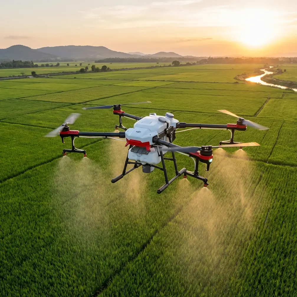
The T50 is not just an agriculture machine when viewed through data discipline
The Agras T50 is often boxed into an agriculture conversation because of its product family and the terminology that surrounds it: swath width, nozzle calibration, spray drift, tank workflow. But for inspection-minded operators, those ideas point to something deeper: control under variable outdoor conditions.
Take spray drift as an example. In agricultural work, drift is a problem of placement accuracy under wind. On a construction site, the parallel issue is sensor and flight-path discipline under gusts. The operator’s need is the same in principle: maintain predictable coverage, avoid unintended spread or deviation, and produce a consistent result over a complex surface.
The same applies to nozzle calibration. Even if you are not spraying anything on a construction project, calibration culture matters. Teams that understand calibration tend to think in terms of repeatability, output quality, and quantified deviation. That mindset is valuable in inspection. A drone workflow should not be “fly and hope.” It should be configured, checked, and verified.
This is one reason the T50 stands apart from lighter platforms that can seem convenient but lose composure when wind funnels between unfinished structures. Heavier-duty systems built for outdoor workload consistency tend to hold their value in hard environments. Not because they are glamorous. Because they are boring in the best possible way. They repeat.
Wind changes what “good enough” means
Many site managers underestimate the effect of wind on data quality. The issue is not only whether the drone can stay airborne. The issue is whether it can collect data that remains operationally useful after processing.
On open construction parcels, wind can do four things at once:
- disturb altitude and attitude stability
- shift the aircraft laterally during capture passes
- stir dust, debris, and atmospheric clutter into the imagery
- create uneven behavior near steel frames, facades, and partially enclosed areas
If you are building a site model meant to support maintenance planning or stakeholder communication, those inconsistencies matter. Harrow’s digital twin is a strong example because its value proposition was not abstract innovation. It was better maintenance, planning, and engagement. The same benchmark should be applied on a construction site. Ask one simple question: does this drone help us make better maintenance and planning decisions next week, not just collect footage today?
The T50’s advantage in that context is less about a single headline feature and more about system behavior under load. Competitors in the lighter enterprise segment may be easier to transport, but they often reach their comfort limit sooner in gusty conditions. When wind rises, the stronger platform tends to preserve consistency longer. For inspection teams, that can mean fewer aborted flights, fewer recaptures, and more usable overlap for model generation.
Digital twin thinking on a live jobsite
Harrow’s method of enriching lower-resolution city data with high-resolution drone imagery is exactly how mature construction teams should think about recurring site inspections.
A practical build-out looks like this:
- Start with your base layer: historical survey, contractor plans, BIM context, prior orthos, or lower-resolution regional mapping.
- Add regular, high-resolution drone capture at key project intervals.
- Align the new imagery to a stable positioning framework.
- Feed that model into maintenance walks, sequencing reviews, safety planning, logistics layouts, and stakeholder updates.
This is where terms like RTK Fix rate and centimeter precision stop sounding like brochure language. They become operational variables. If your fix rate is inconsistent, your repeat flights may not line up well enough for confident comparison. If your positioning lacks centimeter-grade reliability, small but meaningful changes around trench lines, stockpile edges, access routes, or facade progress can become harder to interpret accurately.
For a windy site, that precision discipline becomes even more critical because wind adds a second source of variation on top of positional error. A platform that supports stable, repeatable operations is doing more than helping the pilot. It is protecting the integrity of the time-series dataset.
Why this matters for maintenance before handover
One of the strongest details in the Harrow story is the claim that the expanded digital twin helps reduce maintenance costs. That should catch the attention of construction professionals, because maintenance is where poor site records become expensive.
During the build phase, a high-quality drone-derived model can help teams document drainage paths, roof details, facade conditions, perimeter access, temporary works transitions, and equipment placement. But the larger payoff often comes later. The better the captured record, the easier it is to verify what changed, what was installed, and where attention is needed.
This is especially relevant on projects exposed to rough weather. Windy sites tend to accumulate subtle issues: loose coverings, disturbed edge protection, shifted materials, water ingress indicators, scaffold wrap damage, or surface debris patterns that reveal trouble before failure. If the T50 is used as part of a regular inspection cadence, the output can support a maintenance mindset rather than a reactive one.
That is exactly the logic behind Harrow’s model. They did not invest in high-resolution drone data simply to admire it. They used it to improve the practical work of managing physical assets.
Public engagement has a construction parallel too
Another Harrow detail worth carrying over is public engagement. For a borough, that means communicating with residents and stakeholders. On a construction project, the equivalent audience might be clients, adjacent property owners, consultants, utility partners, or planning authorities.
Windy sites often generate uncertainty because conditions change quickly. A fresh, high-resolution site model helps replace vague status updates with something visual and current. That can reduce friction in coordination meetings. It also helps when the project team needs to explain temporary access changes, crane logistics, material laydown constraints, or why a sequence shifted after weather disruption.
If you are building this kind of communication workflow and want to discuss field deployment specifics, one practical route is to message an Agras specialist here.
Notice how this mirrors the Harrow case. Better drone data improves not just technical planning, but the quality of conversation around the asset.
What to watch operationally when using a T50 on a windy site
The T50 is best understood as a serious outdoor work platform. That is a strength, but only if the team respects the workflow.
1. Treat precision as a process, not a spec
A stated centimeter precision capability only matters when the site setup supports it. Check GNSS conditions, verify the RTK Fix rate, and be disciplined about repeat mission parameters. If your control environment is sloppy, premium hardware will not rescue the output.
2. Build around repeatable capture windows
Wind on construction sites is rarely uniform. It changes with time of day, nearby structures, and thermal effects from concrete and roofing surfaces. The best results come from recurring captures in similar environmental windows, not random flight timing.
3. Don’t borrow agricultural terms lazily—translate them
Words like swath width can still be useful in inspection planning if you reinterpret them as coverage discipline. The question is not how much liquid the aircraft can apply. The question is how efficiently and consistently it can cover a defined inspection corridor or facade band without degrading data quality.
4. Durability matters in dirty weather
A rugged rating such as IPX6K is not a vanity detail on active sites. Wind tends to carry dust, damp residue, and fine particulates into every operation. A platform built for harsh outdoor exposure usually has an advantage over more delicate systems when the environment gets messy.
5. Consider sensor strategy, not just aircraft strategy
Some teams get distracted by whether a platform mentions multispectral workflows. For construction inspection, that may or may not be relevant depending on the job. What matters is choosing the sensing approach that answers the site question. Thermal, visual, and georeferenced progress imagery often produce more value than collecting exotic data nobody uses.
Where the T50 clearly excels against weaker alternatives
Competitor platforms often win the first impression contest because they are compact and familiar. But windy construction inspection is not a first impression exercise. It is a consistency test.
The T50 tends to excel where operators need:
- steadier performance in exposed outdoor conditions
- repeatable route execution over large active areas
- robust field tolerance when dust and moisture become operational factors
- a disciplined workflow that can support model-based decision making
That last point is the one that connects most directly to Harrow’s digital twin. A drone becomes strategically useful when its output can be layered into an evolving model that supports action. Harrow combined rich, current drone imagery with broader existing data to improve planning and maintenance. Construction teams can do the same with the T50 when they stop treating flights as isolated tasks and start treating them as updates to a reliable site twin.
The broader lesson from Harrow
The most valuable takeaway from Harrow is not about municipal technology. It is about information quality.
They expanded a city digital twin by blending high-resolution drone imagery with existing lower-resolution data, then used that richer model to improve planning, maintenance, and engagement. That sequence is exactly what sophisticated construction inspection should aim for, especially on windy sites where low-quality data quickly becomes misleading.
The Agras T50 fits that philosophy well because it is suited to demanding outdoor operations where stability, repeatability, and environmental resilience have outsized value. For teams inspecting exposed construction environments, the real edge is not that the aircraft can fly in wind. Plenty of drones can fly in wind, at least briefly. The edge is that the T50 can help produce data you can trust enough to compare, communicate, and act on.
That is the difference between collecting drone content and building a usable site twin.
Ready for your own Agras T50? Contact our team for expert consultation.