Agras T50 in Steep Vineyards: The Flight Altitude Choice
Agras T50 in Steep Vineyards: The Flight Altitude Choice That Decides Coverage, Drift, and Image Quality
META: A field-focused look at using the Agras T50 in complex vineyard terrain, with practical insight on flight altitude, RTK precision, swath control, drift reduction, and why inspection logic matters before every mission.
Terraced vineyards and hillside rows expose every weakness in aerial work. The terrain changes quickly. Canopy height is inconsistent. Wind behaves badly near slope edges. A setting that looks stable on a flat demonstration field can fall apart over real vines.
That is why the most useful question about the Agras T50 in vineyard work is not simply whether it can fly the job. It can. The harder question is this: what flight altitude actually gives you reliable results when the terrain is broken, the rows are narrow, and the operator needs both usable visual data and disciplined application performance?
My view is straightforward. In complex vineyard terrain, the best altitude is rarely the highest one the mission planner will allow, and it is almost never a fixed number copied from another farm. The right operating window is the one that keeps the aircraft close enough to the canopy to control swath behavior and drift, while maintaining enough vertical margin to absorb terrain change without unstable corrections. For most vineyard blocks, that means planning altitude relative to canopy, not relative to takeoff point, and using RTK-backed terrain consistency as a non-negotiable foundation.
This sounds obvious until the hill starts dropping away beneath the aircraft.
Why altitude matters more in vineyards than in broadacre fields
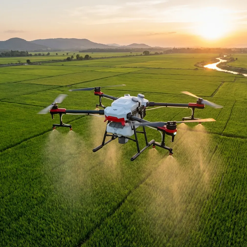
A vineyard is a three-dimensional target. Rows create channels. Slope angle alters downwash interaction. Vines themselves are not a uniform surface; they are gaps, leaves, wire, posts, and changing canopy density. If the T50 flies too high above the vines, the effective swath width becomes harder to trust. Drift risk grows because droplets or particles spend more time exposed before reaching the target zone. If it flies too low without sufficient terrain tracking confidence, the aircraft can overreact to elevation changes and compromise smooth coverage.
That is where the language around spray drift, swath width, nozzle calibration, and centimeter precision stops being marketing vocabulary and becomes operational reality.
The T50 platform is designed for demanding agricultural missions, but steep vineyards punish lazy setup. A broad and stable swath is useful only if it remains aligned with the crop zone. Nozzle calibration matters only if the aircraft maintains the intended height over the canopy and the output pattern reaches the vines as designed. And centimeter-level positioning matters because a row-to-row offset of even a small amount can produce visible inconsistency in coverage or imaging overlap.
The best altitude is canopy-referenced, not map-referenced
If you are filming vineyards with a T50 platform workflow—whether the goal is crop documentation, treatment verification, scouting support, or visual review after application—the key is to think in layers.
There is the terrain surface.
There is the canopy surface.
And there is the flight surface.
In flat fields, operators sometimes get away with treating these as roughly similar. In vineyards on rolling or terraced land, that shortcut creates problems. A mission set from a static elevation can look clean on-screen and still deliver poor real-world consistency because the distance from aircraft to canopy is constantly changing.
The better approach is to maintain a modest, stable altitude above the vine canopy, not above the hillside base. This helps in three ways:
More consistent visual capture
If the aircraft stays within a controlled band above the canopy, image scale changes less from pass to pass. That matters if you are comparing row health, canopy gaps, stress signatures, or treatment uniformity later.More predictable swath behavior
Even when the T50 is being used in an agricultural mission rather than pure filming, keeping a stable crop-relative altitude supports more reliable deposition. In vineyards, the canopy itself is the target geometry.Lower exposure to cross-slope drift
On a hillside, wind often shears across rows differently at 2 meters versus 5 meters above canopy. A tighter altitude window reduces the time droplets or fine output remain suspended before contacting the vines.
I do not recommend treating altitude as a single universal number. Instead, define an acceptable canopy-relative range and verify whether the aircraft can hold it smoothly over the block. If it cannot, the mission design needs work before the aircraft leaves the ground.
RTK fix rate is not a luxury in steep row systems
Many operators talk about RTK as though it is mainly for mapping accuracy. In vineyard work, that is too narrow. RTK fix rate influences whether the aircraft can hold disciplined paths when the terrain, rows, and obstacles all compete for attention.
The phrase “centimeter precision” gets repeated often, but its practical meaning is simple: the aircraft knows where it is with enough confidence to keep row alignment tight and avoid unnecessary lateral wandering. In vineyards, that matters because each pass is visually and agronomically exposed. A slight path shift can show up as uneven overlap in captured imagery or variable treatment along the edge of a row.
The provided reference material on powerline inspection offers a useful parallel. It notes that transmission lines and towers are spread across long, complex networks, making maintenance difficult and risky for human crews, and that drones reduce the need for workers to climb structures. That operational lesson transfers well to vineyards in broken terrain. The value is not just that the drone flies. The value is that it allows precision work in places where ground access is slow, awkward, or unsafe.
The same reference also highlights that foreign objects on high-voltage lines can threaten service reliability, and traditional removal can be slow and may require interruption of operations. For vineyard managers, the analogy is strong: a hillside block with inconsistent aerial coverage may not shut down a power grid, but it does create a chain of downstream issues—retreatment, uncertain crop protection, wasted input, and fragmented data. Precision is not abstract. It preserves continuity.
A practical altitude insight for complex vineyards
Here is the operational principle I give most often: fly as low as the canopy and terrain model allow, but only as low as the aircraft can remain smooth and stable without constant correction.
That means the ideal altitude is the lowest one that still protects four things:
- canopy clearance over sudden rises,
- stable aircraft attitude,
- intended swath geometry,
- and clean row-to-row consistency.
If you descend too aggressively in steep terrain, the aircraft may chase elevation changes instead of executing a clean line. If you stay too high, you gain clearance but lose control over deposition and image consistency. The sweet spot is where the T50 is close enough to the vines to reduce drift and preserve detail, yet not so close that every terrace edge or canopy bulge triggers disruptive movement.
This is also where nozzle calibration and flight altitude must be treated as a matched pair. Calibration done on a flat surface loses meaning if the actual mission height above canopy is drifting wildly. In other words, a well-calibrated output system cannot rescue a badly chosen altitude strategy.
Why imaging logic matters even when the mission is agricultural
The reference set includes another revealing item: the Embir-3 thermal camera was added to the Blue UAS Framework, with NDAA compliance and recognition by the Defense Innovation Unit. The security and procurement side of that listing is not the key takeaway here. The more useful point for civilian vineyard operations is this: thermal payloads are being judged on compactness, platform integration, and trusted deployment standards because airborne sensing now has to be operationally dependable, not merely experimental.
For a T50 user in vineyards, that matters because thermal and other imaging workflows are increasingly part of practical farm decisions. You may not be flying the exact payload named in that news item, but the broader lesson is relevant: compact airborne sensing has matured into a serious decision tool. In vineyards, thermal or multispectral review can reveal irrigation irregularity, blocked emitters, stress variation across slope aspects, and canopy anomalies that are hard to see from the ground.
When terrain is complex, image quality depends heavily on stable height above target. A thermal frame captured from inconsistent altitude is harder to compare across rows. A multispectral dataset with poor overlap or changing scale becomes less trustworthy for agronomic interpretation. So even if your primary mission is not “filming” in the cinematic sense, the flight discipline required for good visual data is inseparable from the discipline required for good agricultural work.
Weatherproofing and cleanup discipline are underrated in vineyard operations
The T50’s IPX6K protection level matters more in vineyards than many operators admit. Not because water resistance sounds impressive on a specification sheet, but because vineyard missions tend to involve dust, residue, splashing during refill cycles, and long workdays where hurried cleanup creates reliability problems later.
Complex terrain often means remote access points, uneven loading areas, and repeated relocation of support equipment. An aircraft built to tolerate demanding field conditions is valuable, but only if the crew respects maintenance routines. Sensors, nozzles, and frame surfaces should be checked with the same seriousness as route planning. If altitude control starts to feel inconsistent, do not assume it is a software issue first. Field contamination and setup drift deserve immediate suspicion.
A note on using training logic, not just agricultural logic
One of the provided documents discusses Aresti notation, the symbol language invented by Jose Luis Aresti in 1969, used to break complex aerobatic maneuvers into readable components such as full 360-degree rolls and fractional turns like 1/4 or 3/4. That may seem distant from vineyard work, but there is a useful training lesson buried in it.
Good pilots do not master complexity by memorizing a finished pattern. They learn to deconstruct motion into understandable pieces. The same should happen with T50 vineyard missions. Instead of telling crews to “fly lower for better detail” or “raise altitude for safety,” break the mission into components:
- row spacing,
- canopy height variation,
- terrain step change,
- wind direction relative to slope,
- desired image overlap,
- target swath behavior,
- and expected RTK stability.
When operators think in symbols, sequences, and repeatable cues—much like reading a flight figure—they make fewer emotional adjustments in the air. That reduces the kind of improvised altitude changes that cause drift, patchy overlap, or inconsistent application.
The hidden advantage of drones in difficult agricultural terrain
The strongest message from the reference material on drone use in wildlife and powerline settings is not about hardware. It is about removing people from unnecessary exposure. The document describes drones entering hard-to-reach wildlife areas to observe populations and habitats, and it also describes how drones can handle dangerous powerline tasks without requiring workers to climb towers.
For vineyard managers, the equivalent benefit is easy to miss because it feels less dramatic. Yet it is real. In steep vineyards, every task shifted from repeated foot access or vehicle repositioning to a disciplined aerial workflow saves time, reduces fatigue, and often produces a better record of what happened. That includes scouting hard-to-reach rows, checking canopy uniformity after treatment, and reviewing edge zones where terrain makes ground inspection slow.
A T50 is not valuable merely because it can cover land. It becomes valuable when it shortens the loop between observation and action.
What operators should do before flying a complex vineyard block
Before launching, I recommend a simple decision framework:
- Confirm RTK stability and do not normalize weak fix behavior.
- Set altitude relative to canopy, not merely the launch point.
- Validate nozzle calibration against the actual mission height window.
- Reduce ambition on swath width if terrain complexity demands tighter control.
- Use imaging passes to verify whether your height strategy is producing consistent target detail.
- Watch slope wind, not just general wind.
If your team is trying to refine a T50 setup for steep vineyard rows and wants to compare route logic or canopy-height strategy, you can message a field specialist here.
The T50 performs best in vineyards when altitude becomes a controlled variable rather than a guessed setting. On complex ground, that single decision influences drift, coverage, crop safety, and the quality of the visual record you bring home. Too high, and you lose precision. Too low, and the aircraft starts fighting the terrain. Get the canopy-relative window right, and the rest of the mission becomes far easier to trust.
Ready for your own Agras T50? Contact our team for expert consultation.