Agras T50 Coastline Filming in Urban Areas
Agras T50 Coastline Filming in Urban Areas: A Practical Workflow When Wind, Salt Air, and GPS Conditions Start Fighting Back
META: A field-tested how-to for using the Agras T50 around urban coastlines, with mission planning, overlap logic, RTK-style positioning discipline, weather adjustments, and sensor workflow insights grounded in real UAV mapping references.
Urban coastline work looks simple from a distance. Water on one side, buildings on the other, a clean strip to document. In the field, it is rarely that polite.
Sea breeze shifts faster than inland wind. Reflective surfaces confuse visual judgment. GNSS conditions can change block by block near towers and port infrastructure. Salt mist gets into everything. And if you are trying to collect usable visual data rather than pretty-but-disconnected clips, the difference between a smooth mission and a waste of flight time comes down to planning discipline.
That is where the Agras T50 becomes interesting.
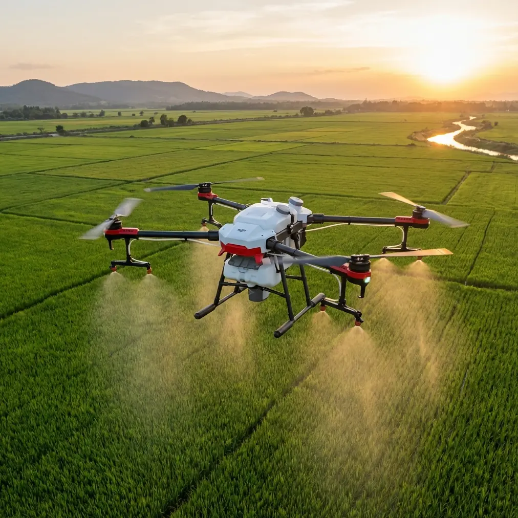
Most people hear “Agras” and think only about agricultural operations. That misses a broader operational point. The T50 is fundamentally a heavy-duty working aircraft platform designed to keep performing in messy outdoor conditions. When you adapt that mindset to urban coastline filming and documentation, the result is not cinematic improvisation. It is structured capture with enough resilience to keep going when the weather turns halfway through the mission.
This article walks through a practical approach. Not a generic flying primer. A real method shaped by two useful reference ideas: first, a mapping workflow that ties field registration and orthomosaic quality to specific flight settings; second, a professional multirotor specification set that shows what long endurance, carbon-fiber structure, payload flexibility, and weather tolerance mean in actual operations.
Start with the real goal, not the drone
If the assignment is “film the coastline,” that is too vague to produce consistent results.
In urban coastal work, there are usually three different outputs hiding inside one brief:
- Context footage for visual storytelling
- Structured image capture for measurable documentation
- Thermal or specialty imaging when surface condition, heat signatures, or infrastructure monitoring matter
The reference mapping workflow is useful here because it refuses to treat aerial capture as random sightseeing. It specifies a measurable target: orthophoto output with spatial resolution better than 5 cm, achieved with a 20 MP camera at 120 meters. That matters even if your T50 mission is not pure surveying.
Why? Because it gives you a benchmark for mission discipline. If your coastline footage must later support inspection, shoreline change review, drainage assessment, or infrastructure coordination, then capture geometry matters. Height matters. Overlap matters. Camera angle matters. Without those, your footage is visually attractive but operationally weak.
The same reference recommends 70% forward overlap and 60% side overlap for reliable image products. Again, that sounds like mapping language, but the logic carries over directly to urban coastline filming. Overlap is what protects you when waves, glare, and wind create inconsistent frames. It also gives you options later if the project evolves from “just video” into a stitched record of revetments, seawalls, rooftop edges, or pedestrian waterfront zones.
Build the flight around reference points on the ground
One of the smartest details in the ArcGIS workflow is not about the aircraft at all. It is about field registration.
The operator is instructed to find an easily identifiable point on the satellite basemap—a crossroads, a building corner, something unmistakable—stand at that location, align the crosshair, and tap “I am here” so the system can complete on-site registration.
That is operationally significant for coastline work because urban waterfronts often contain exactly the kind of mixed geometry that creates confusion later: curved promenades, repeating lamp posts, reflective roofs, sea walls that look identical for long stretches, and open water with no persistent visual anchors. If you launch without a confirmed real-world reference, your beautifully flown mission can become difficult to reconcile with municipal plans, site logs, or previous data capture.
So before takeoff with the T50, establish at least one hard ground reference and preferably several:
- intersection corners
- jetty endpoints
- pier access gates
- building corners facing the water
- drainage outlets or marked utility structures
This is not glamorous. It is what makes the output defensible.
Height is not just about clearance; it defines usable detail
The source workflow repeatedly points to 120 meters: flight height, return-to-home height, and the data quality expected from that altitude.
For the Agras T50 in an urban coastline setting, 120 meters is not a universal answer, but it is a strong planning anchor. It gives enough elevation to smooth out short-term control inputs, widen your scene, and reduce the frequency of obstacle negotiation near shoreline structures. At the same time, it keeps enough ground detail for documentation-oriented capture when your optics support it.
The reason this number matters is not because every mission should copy it blindly. It matters because it links altitude to deliverable quality. Too many coastal operators choose height emotionally: lower for drama, higher for safety, somewhere in the middle because it “looks right.” The better method is to decide what detail threshold the client needs, then back into height, speed, and overlap.
If your goal is coastal condition monitoring rather than only promotional visuals, keep this mindset: altitude is a data-quality decision first.
Mid-flight weather changes are where the platform either earns trust or doesn’t
On one recent-style urban coastline scenario, the morning started flat enough for a straightforward shoreline pass. Fifteen minutes later, the sea breeze strengthened, the air turned wet, and the exposure balance over water shifted from manageable to annoying. This is exactly where lesser planning shows up.
The second reference, describing the iFly D1 emergency mapping multirotor, offers an important benchmark for professional field thinking. It highlights traits such as 70 minutes of endurance, Level 6 wind resistance, small-rain operability, 10 km control radius, and a 10-minute setup time, all built around a carbon-fiber airframe and modular payload logic.
No, that aircraft is not the Agras T50. But those details are still valuable because they define what serious operators expect from a working drone in unstable conditions: enough endurance margin to wait out a weather shift or rerun a segment, enough structural stability to hold a useful line in wind, and enough environmental durability that the mission does not collapse the moment airborne moisture arrives.
That same mindset is why the T50 has appeal in harsh outdoor work. Around salt air and changeable waterfront wind, you want a machine that feels engineered for exposure, not sheltered from it. This is where features associated with working-platform durability—think along the lines of IPX6K-style washdown resilience, strong propulsion authority, and robust frame design—matter more than brochure aesthetics.
When the wind picked up mid-flight, the right move was not to force the original plan. It was to shorten the downwind leg, preserve battery reserve, increase spacing from façade lines, and prioritize stable oblique passes over low-altitude drama near reflective water. The T50-type operating philosophy supports exactly that adjustment: keep the mission useful, not heroic.
Camera discipline beats improvisation over water
The reference mapping procedure notes that the camera is automatically set to point straight down before takeoff for orthographic capture. That is a reminder that camera angle is not a stylistic afterthought. It should match the output.
For coastline work, divide your capture into three passes:
1. Nadir pass
Use top-down coverage when the goal is shoreline continuity, roof-edge relation to the coast, paved surface mapping, drainage tracing, or orthomosaic generation.
2. Low oblique pass
Use this to reveal the relationship between urban edge and waterline—seawalls, promenade furniture, flood barriers, mooring areas, and public access routes.
3. Selective detail pass
Reserve this for erosion pockets, damaged concrete, ponding areas, debris accumulation zones, or structure transitions.
The operational lesson from the 70/60 overlap guidance is simple: if you expect to extract decisions from the footage later, capture redundancy deliberately. Water surfaces and edge transitions generate enough ambiguity already. Redundancy is not wasted effort.
Precision matters more near buildings than out over the water
The user context points toward RTK-style expectations, and that is exactly right. In urban coastlines, your biggest headaches usually happen at the land-water interface where structures, retaining edges, roads, and utilities all converge.
A strong RTK fix rate or equivalent centimeter-grade positioning discipline does two things:
- reduces positional drift between passes
- makes repeat missions actually comparable over time
That second point is huge. If you revisit a coastal district after a storm season or after infrastructure work, you need consistent geometry to see what changed. Without that, “before and after” becomes subjective.
This is one reason the field registration concept from the ArcGIS source is so valuable. Even with good satellite positioning, tying the mission to recognizable on-site points improves confidence when urban conditions start degrading signal quality.
What about multispectral or thermal on a coastline job?
Most people think of multispectral only in crop analysis, but coastal urban work can benefit from specialty sensors too—especially where vegetation health, drainage patterns, sediment behavior, or wetness differentiation matter. The second reference reinforces the usefulness of payload flexibility by mentioning optional visible-light, oblique, hyperspectral, and infrared configurations on a professional multirotor platform.
Thermal is especially relevant in civilian waterfront operations:
- identifying abnormal surface heating on roofs near the shore
- spotting wet insulation signatures
- reviewing drainage outlets
- checking equipment housings or utility interfaces
- contrasting sun-loaded concrete and cooler moisture-retaining areas
The thermal specifications in the reference are notable: 640×480 detector resolution, 50/60 Hz frame rate, 8–14 μm spectral band, and temperature accuracy around ±2°C or ±2%. Those are not trivia. They explain whether a thermal payload is merely illustrative or genuinely useful for inspection logic.
If you are adapting a T50-centered workflow for more than visual capture, think in terms of payload purpose, not gadget stacking.
A note on swath width, speed, and what operators often get wrong
Coastline missions tempt people to fly too fast because the route looks linear and obvious. That is a mistake.
A wider swath width sounds efficient, but if speed outruns shutter discipline, overlap, or stabilization in gusting sea air, your coverage quality falls apart at the edges first. Urban coastline jobs rarely fail in the middle of the frame. They fail where roads meet sea defenses, where roofs meet parapets, and where shadowed structures meet specular water.
The mapping source’s emphasis on fixed mission geometry is the cure. Define height. Define overlap. Define return-to-home altitude. Then fly a repeatable pattern instead of improvising every leg.
If you need help pressure-testing a mission design before heading to the waterfront, you can send the layout through this direct planning channel: coastline mission review on WhatsApp.
Don’t ignore landing behavior in tight shoreline zones
One small detail in the source material stands out because it is so practical: automatic return landings may be offset from the takeoff point by roughly 20 centimeters, and operators should be prepared to fine-tune the landing or switch to manual at low altitude if needed.
That matters a lot in urban coastline environments.
You may be launching from:
- narrow paved shoulders
- rooftop edges
- marina access areas
- compact staging pads near fencing or street furniture
In those places, a small landing deviation is not theoretical. It can be the difference between a clean recovery and contact with rails, bollards, or wet uneven surfaces. The source is right to treat this as an operational detail rather than a footnote.
With a larger working drone mindset like the T50’s, landing zone discipline should be stricter, not looser.
The practical T50 coastline workflow
Here is the condensed method I would use:
Pre-mission
- define whether output is cinematic, documentary, orthographic, or thermal
- mark clear ground reference points visible both on map and on site
- review wind trend, not just current wind
- set a conservative recovery area
Mission design
- use a height benchmark around 120 m when documentation quality and area context both matter
- preserve at least 70% forward and 60% side overlap for structured image capture
- split the mission into nadir, oblique, and detail passes
- set return-to-home altitude high enough for nearby urban obstacles
In flight
- monitor fix stability and drift near dense structures
- if weather shifts, reduce complexity before quality collapses
- prioritize repeatable geometry over dramatic low passes
- keep enough reserve to rerun one critical segment
Recovery
- expect slight auto-landing offset
- hand-correct the final descent if the pad is constrained
- inspect the aircraft carefully after salt-air exposure
Why this approach fits the Agras T50 better than casual filming habits
The T50 makes the most sense when you use it like a professional outdoor tool rather than a floating camera stand. The references support that philosophy clearly. One shows how disciplined height, overlap, registration, and autonomous execution produce dependable results. The other shows what rugged multirotor field performance looks like when endurance, weather tolerance, payload flexibility, and operational efficiency are treated as mission requirements.
Put those ideas together, and the T50 stops being an unusual choice for coastline work. It becomes a logical one for operators who care about consistency under imperfect conditions.
And that is the real dividing line in urban coastal filming. Not whether the aircraft can get airborne, but whether it can produce usable, repeatable results after the wind shifts, the moisture rolls in, and the shoreline starts reflecting everything back at you.
Ready for your own Agras T50? Contact our team for expert consultation.