Agras T50 at the Edge of the Field: Best Practices
Agras T50 at the Edge of the Field: Best Practices for Coastal, High-Altitude Work
META: A practical, expert-led Agras T50 guide for coastal and high-altitude operations, covering antenna placement, RTK stability, spray control, orthomosaic-style field verification, and data-driven agricultural workflows.
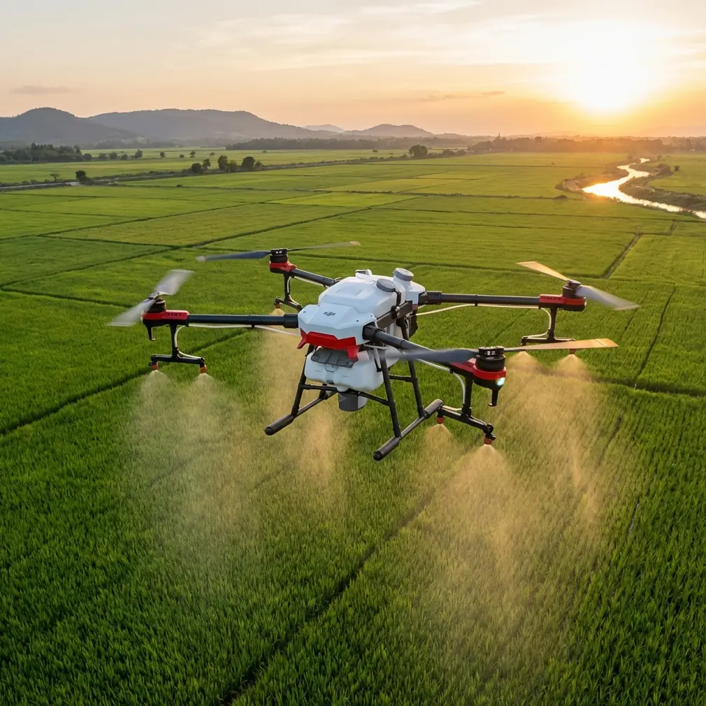
The Agras T50 is often discussed as a spraying platform. That framing is too narrow.
In difficult environments—especially coastal blocks, elevated terraces, wind-exposed reclamation zones, and fragmented fields—the T50 becomes part aircraft, part sensing node, part evidence-collection tool. If you are operating near shorelines at altitude, the real question is not simply how much liquid the platform can move. The better question is how to keep application quality, navigation integrity, and field documentation reliable when terrain, wind, and signal conditions are all working against you.
That matters because the problems of coastal agriculture are rarely one-dimensional. Salt-laden air affects visibility and maintenance cycles. Terrain changes distort height consistency over crop canopies. Wind shear at ridgelines changes droplet behavior. And when fields are broken into smaller parcels, every turn, refill, and route decision starts to influence productivity.
A useful way to think about the T50 is through two proven ideas from broader UAV practice.
First, low-altitude drone remote sensing has already shown its value in construction monitoring because it can produce high-resolution orthophotos quickly, at relatively low cost, and on short operating cycles. In one land-consolidation monitoring case, UAV imagery was used not just for progress tracking but also as traceable evidence for later disputes. That is a big operational lesson for T50 users: in exposed or complex agricultural sites, the mission is not only application. It is also verification.
Second, agricultural UAV systems become most valuable when they connect route planning, onboard sensing, and wireless data transfer into one loop. A field workflow that starts with parcel information at the ground station, continues through sensor-based collection in flight, and ends with wireless transfer to a terminal is far more resilient than a workflow based on pilot memory and rough estimates. For T50 operators working remote coastlines or mountain-adjacent farms, that systems view is what separates repeatable results from improvised flying.
Why coastal, high-altitude T50 operations are different
High-altitude coastal work combines two stressors that can quietly degrade output.
The first is wind behavior. Open coastlines can create crosswinds that look manageable at takeoff but become turbulent over cliffs, embankments, seawalls, or terraced crop edges. That directly affects spray drift, droplet deposition, and overlap consistency across the swath width.
The second is signal geometry. If the aircraft is working around slopes, structures, or irregular field boundaries, your control link and RTK Fix rate can fluctuate more than they would on a flat inland block. Even when the drone remains flyable, degraded positioning can show up later as uneven pass spacing, missed strips, or inefficient route recovery.
This is where centimeter precision stops being a brochure phrase and becomes practical. In fragmented fields, a few small positional errors repeated across multiple passes can leave untreated bands or create over-application zones. Near the coast, those mistakes are harder to hide because wind already narrows your operating margin.
Start with mission direction, not just effort
One of the supplied reference pieces makes a surprisingly relevant point, even though it comes from photography: direction matters more than blind effort. Beginners often prefer an “all-in-one” setup because they do not yet know what they are best suited to shoot. The agricultural version of that mistake is trying to use the same T50 workflow for every field condition.
A coastal, elevated mission needs its own direction.
Do not begin by asking how fast you can finish. Begin by asking what the field is most likely to punish:
- crosswind drift,
- weak RTK geometry,
- canopy-height variation,
- corrosion exposure,
- fragmented access patterns,
- or incomplete documentation after the job.
That framing changes everything. It affects where you place the crew, how you stage batteries and payloads, how you set route orientation, and what post-flight records you keep.
Antenna positioning advice for maximum range
If you want stable range and fewer control interruptions, antenna placement deserves the same attention as nozzle calibration.
For coastal high-ground work, place the remote controller or relay position where it has the cleanest possible line of sight to the full treatment block, not just the takeoff zone. Pilots often stand where access is convenient. That is rarely the best RF position. On sloped coastline parcels, moving a short distance to a higher, unobstructed point can materially improve link stability.
A few practical rules help:
1. Prioritize line of sight over comfort
Avoid setting up behind vehicles, metal sheds, retaining walls, or dense tree rows. Even partial obstruction can hurt signal quality when the aircraft drops behind terrain folds.
2. Keep antennas oriented for the work area, not the horizon
Aim your antenna setup toward the active treatment sector. If the field stretches along a coastal edge, align for that corridor rather than pointing broadly outward.
3. Avoid multipath-heavy surfaces
Wet concrete, sheet metal roofs, parked machinery, and water surfaces can all increase signal reflections. Near shorelines, that effect can be more pronounced.
4. Reassess after each parcel shift
Antenna geometry that works on one terrace may be poor for the next. When you reposition tanks or support crew, reassess the control point rather than assuming the first location is still optimal.
If your operation has recurring link drops on the same side of a field, that is usually not random. It is often a terrain-shadow problem or a poor controller setup position. Correct that before changing flight speed or reducing productivity.
If you need a second opinion on field-side setup logic, this Agras T50 operations chat line can be useful for comparing site layouts before deployment.
Protect RTK performance like a crop input
In coastal and elevated terrain, RTK stability influences more than mapping-grade neatness. It affects application quality.
The reference material on agricultural information acquisition emphasizes route planning based on field parcel data, then collection through onboard sensors, followed by data transfer back to the user. That chain only works well when positional confidence remains strong. If the RTK Fix rate is unstable, the route may still execute, but your confidence in exact pass placement declines.
For T50 operators, that means:
- confirm base or correction-link reliability before loading a full mission,
- test lock quality in the most terrain-challenged corner of the field,
- watch for fix degradation during low runs near embankments or tree margins,
- and log where positioning instability occurs so future missions can be redesigned.
Centimeter precision matters most where swath spacing leaves little room for drift. High-output platforms cover ground quickly, but their productivity only counts if each lane lands where intended.
Route planning should follow agronomy and wind, not convenience
The agricultural reference also highlights UAV flight path planning as a core technology, and that is not academic theory. On the T50, route planning is where many application errors either begin or get prevented.
In coastal high-altitude work:
- Fly parallel to the longest stable working line where possible.
- Reduce unnecessary turns on narrow terraces or fragmented plots.
- Use wind-aware route orientation to reduce lateral drift.
- Separate exposed edge zones from interior zones if wind conditions differ sharply.
If one section faces open sea and another is protected by topography, treat them as different micro-environments. A single uniform mission profile can produce inconsistent deposition.
This is also where multispectral scouting, if available in your broader operation, becomes strategically useful even if the T50 itself is focused on treatment. Stress patterns, drainage problems, and uneven vigor often align with spray-risk zones. That lets you prioritize which blocks need tighter tolerances and which can accept a more standard application profile.
Spray drift control begins before takeoff
Coastal operators know that drift is not only a compliance issue. It is a performance issue. Product that leaves the target zone is wasted, and in shoreline-adjacent agriculture the margin for off-target movement can be narrow.
Three T50 habits matter here:
Nozzle calibration
Calibration should be treated as a routine control point, not a seasonal task. In windy, elevated sites, any inconsistency in flow or droplet formation becomes more obvious because the air mass is already less forgiving.
Height consistency
A stable height above canopy is essential for keeping the swath width predictable. Over uneven ground, poor terrain following can create alternating under- and over-coverage.
Conservative edge strategy
Field edges nearest roads, drainage lines, neighboring plots, or open shoreline should be handled with the strictest drift discipline. Sometimes that means adjusting speed, spacing, or timing rather than pushing for maximum hourly output.
The T50’s productivity is valuable, but at exposed sites the better operator is often the one who knows when not to chase nominal capacity.
Borrow a lesson from land-consolidation monitoring: document the work
One of the strongest reference insights comes from a land-consolidation UAV monitoring study. It argued that high-resolution orthophotos do more than show progress. They preserve ground truth and provide a traceable record if questions arise later.
That logic fits T50 operations better than many teams realize.
After treatment in complicated coastal blocks, maintaining a record of:
- treated parcel boundaries,
- mission date and time,
- route version,
- weather window,
- RTK quality,
- refill counts,
- and any exceptions or skipped strips
creates a defensible operational history. If a grower later questions coverage, timing, or block completion, your records should not rely on memory.
The land-consolidation case also referenced substantial infrastructure verification, including 13 bridges and 9 sluices, as part of project monitoring. The agriculture takeaway is simple: UAV operations become more valuable when they verify many field realities at once. With the T50, you are not only applying product. You can also confirm access conditions, note drainage issues, identify blocked lanes, and capture visual context that improves the next mission.
Wireless data transfer is not a luxury feature
The agricultural information reference explicitly describes a workflow where field data can be stored onboard or transmitted via Bluetooth, Wi-Fi, or radio-frequency methods to a terminal. That may sound basic today, but the principle is still sharp: a drone system is only as useful as its ability to turn flight activity into accessible information.
For T50 teams, especially those covering remote coastline parcels, this means standardizing how data leaves the aircraft and reaches decision-makers. Fast transfer supports:
- same-day treatment verification,
- rapid route corrections for the next block,
- maintenance notes after salt-heavy operations,
- and cumulative performance analysis across fragmented parcels.
Without that feedback loop, even a strong aircraft becomes a disconnected tool.
Maintenance matters more near the sea
The context hint of IPX6K matters in a coastal article because weather resistance and wash-down tolerance are not abstract specifications in salt-prone environments. Fine salt deposition can accelerate wear on exposed surfaces, connectors, landing gear interfaces, and spray-system components.
After shoreline missions, post-flight cleaning should be disciplined rather than cosmetic. Rinse routines, inspection of nozzle condition, and attention to residue buildup around moving parts should be part of the standard checklist. Weather resistance helps, but it does not replace maintenance.
A smarter T50 operating model
The best T50 coastal workflow is usually not “bigger tank, faster passes, more hectares.” It is a three-part operating model:
Plan precisely
Build the route from actual parcel geometry, wind exposure, and terrain logic.Apply conservatively where risk is high
Protect drift control, positioning quality, and edge accuracy.Verify with evidence
Keep records that show what was treated, how it was treated, and what conditions were present.
That model aligns closely with the two strongest source themes in your reference set. One source shows that UAVs are highly effective when they can rapidly generate truthful, traceable field records. The other shows that agricultural UAV systems deliver the most value when flight control, route planning, sensing, endurance, and wireless transmission are treated as one integrated chain.
For the Agras T50, that is the real story. Not generic power. Not generic automation. Operational intelligence.
And when you are delivering treatment performance across high-altitude coastal fields, that intelligence is what keeps precision from turning into guesswork.
Ready for your own Agras T50? Contact our team for expert consultation.