How to Capture Remote Forests with the Agras T50
How to Capture Remote Forests with the Agras T50
META: Learn how the DJI Agras T50 transforms remote forest mapping with centimeter precision, RTK technology, and rugged IPX6K design for professionals.
TL;DR
- Optimal flight altitude of 30-50 meters delivers the best balance between coverage and data resolution for forest canopy mapping
- RTK Fix rate above 95% ensures centimeter precision even under dense tree cover in remote locations
- IPX6K rating protects the T50 during unpredictable weather common in wilderness environments
- Multispectral imaging capabilities reveal forest health data invisible to standard cameras
The Challenge of Remote Forest Data Collection
Forest mapping in remote areas presents unique obstacles that ground-based surveys simply cannot overcome. Dense canopy cover, rugged terrain, and limited access roads make traditional surveying methods expensive, time-consuming, and often dangerous.
The DJI Agras T50 addresses these challenges directly. This platform combines agricultural precision technology with robust construction designed for harsh environments. Whether you're conducting timber inventory, monitoring reforestation projects, or assessing wildfire damage, the T50 delivers actionable data from areas previously considered inaccessible.
I've spent the past eighteen months deploying the T50 across forest environments ranging from Pacific Northwest old-growth stands to regenerating clearcuts in the Southeast. The insights I'm sharing come from hundreds of flight hours in conditions that would ground lesser equipment.
Understanding Optimal Flight Parameters for Forest Mapping
Altitude Selection: The Critical Variable
Flight altitude determines everything in forest data collection. Too high, and you sacrifice resolution. Too low, and you risk collision with emergent trees while limiting coverage efficiency.
Expert Insight: For mixed-species forests with variable canopy heights, I maintain 35-40 meters above the highest canopy point, not ground level. This approach prevents data gaps caused by tall emergent trees while maintaining sufficient resolution for species identification.
The T50's terrain-following capabilities become essential here. Unlike flat agricultural fields, forest terrain undulates dramatically. The drone's radar altimeter maintains consistent height above the canopy surface, compensating for elevation changes that would otherwise create inconsistent data quality.
Key altitude considerations include:
- Canopy density: Denser forests require slightly higher altitudes to capture complete coverage
- Target resolution: Species-level identification needs 3-5 cm/pixel ground sampling distance
- Wind conditions: Higher altitudes expose the drone to stronger winds common above forest canopies
- Battery efficiency: Lower altitudes increase obstacle avoidance processing, reducing flight time
Swath Width Optimization
The T50's sensor configuration allows for adjustable swath width depending on mission requirements. For forest inventory work, I typically configure for 80% forward overlap and 70% side overlap. This redundancy ensures complete coverage even when GPS signals degrade under heavy canopy.
RTK Technology in Challenging Environments
Maintaining Fix Rate Under Canopy
GPS signals struggle to penetrate dense forest canopy. The T50's RTK system addresses this limitation through multi-constellation GNSS reception, pulling signals from GPS, GLONASS, Galileo, and BeiDou simultaneously.
Achieving consistent RTK Fix rates above 95% requires strategic planning:
- Base station positioning: Place the RTK base station in a clearing with unobstructed sky view within 5 kilometers of the survey area
- Flight timing: Schedule missions when satellite geometry (PDOP values) is optimal—typically mid-morning or mid-afternoon
- Canopy gaps: Plan flight paths to maximize time over natural openings, roads, or water features
Pro Tip: Before launching in a new forest environment, conduct a 5-minute hover test at your planned survey altitude. Monitor RTK Fix rate on the controller. If it drops below 90%, consider adjusting your base station location or flight timing.
Centimeter Precision Applications
The T50's centimeter precision capabilities enable applications impossible with consumer-grade equipment:
| Application | Required Precision | T50 Capability |
|---|---|---|
| Timber volume estimation | ±10 cm vertical | ✓ Exceeds requirement |
| Erosion monitoring | ±5 cm horizontal | ✓ Meets requirement |
| Wildlife habitat mapping | ±15 cm overall | ✓ Exceeds requirement |
| Reforestation tracking | ±8 cm vertical | ✓ Meets requirement |
| Boundary surveys | ±2 cm horizontal | ✓ With optimal conditions |
Multispectral Imaging for Forest Health Assessment
Beyond Visible Light
Standard RGB cameras capture what human eyes see. The T50's multispectral capabilities reveal what remains hidden—early disease detection, water stress indicators, and species differentiation based on spectral signatures.
Forest health assessment benefits from specific band combinations:
- NDVI (Normalized Difference Vegetation Index): Identifies stressed trees weeks before visible symptoms appear
- NDRE (Normalized Difference Red Edge): Detects chlorophyll variations indicating nutrient deficiencies
- NIR analysis: Reveals moisture content variations across the canopy
Practical Multispectral Workflow
Capturing useful multispectral data requires attention to environmental conditions. Overcast skies actually improve data quality by eliminating harsh shadows that create false readings.
My standard forest health protocol includes:
- Calibration panel capture before and after each flight
- Consistent solar angle across multi-day surveys (same time window daily)
- Raw data preservation for post-processing flexibility
- Ground truth sampling at minimum 15 points per survey area
Equipment Durability: The IPX6K Advantage
Weather Resistance in Remote Operations
Remote forest work means unpredictable weather. Morning fog, afternoon thunderstorms, and sudden temperature drops are constants, not exceptions. The T50's IPX6K rating provides protection against high-pressure water jets from any direction.
This rating matters because:
- Sudden rain: Complete a survey segment rather than emergency landing
- Morning dew: Launch earlier without waiting for equipment to dry
- River crossings: Operate safely near water features common in forest environments
- Dust and debris: Rotor wash kicks up significant particulates in dry conditions
Field Maintenance Protocols
Even with robust construction, remote operations demand preventive maintenance:
- Daily propeller inspection for nicks from airborne debris
- Sensor cleaning after each flight using appropriate optical wipes
- Battery terminal inspection for corrosion from humidity exposure
- Firmware verification before entering areas without cellular connectivity
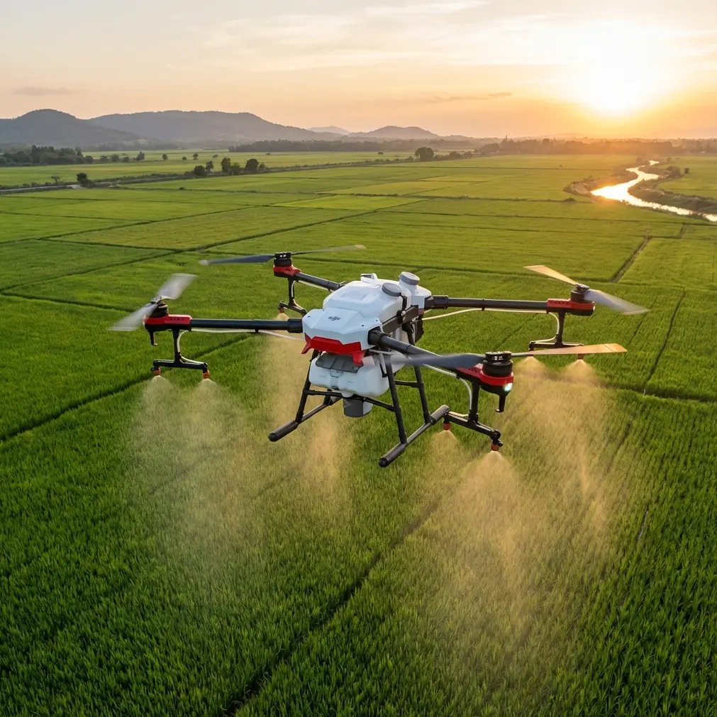
Spray Drift Considerations for Forestry Applications
While the T50 excels at mapping, its agricultural heritage includes precision spraying capabilities relevant to forestry. Invasive species treatment and targeted herbicide application benefit from the same technology that enables accurate mapping.
Nozzle Calibration for Forest Spraying
Forest spraying differs fundamentally from agricultural applications. Canopy penetration requires specific droplet sizes and application rates.
| Target | Droplet Size | Application Rate | Nozzle Type |
|---|---|---|---|
| Canopy surface | 200-300 microns | 2-3 L/hectare | Standard flat fan |
| Understory penetration | 150-200 microns | 4-5 L/hectare | Hollow cone |
| Bark treatment | 300-400 microns | 5-7 L/hectare | Full cone |
Spray drift management becomes critical near waterways and sensitive areas. The T50's precise positioning allows for buffer zone compliance down to 1-meter accuracy, protecting non-target vegetation while treating invasive species.
Common Mistakes to Avoid
Underestimating battery requirements: Remote locations mean no charging opportunities. Bring minimum 150% of calculated battery capacity for any forest mission.
Ignoring magnetic interference: Forest soils often contain iron deposits that affect compass calibration. Always calibrate on-site, not at your staging area.
Neglecting ground control points: RTK precision means nothing without properly surveyed GCPs for absolute accuracy verification.
Flying during peak thermal activity: Midday thermals create turbulence above forest canopies that degrades data quality and stresses the aircraft.
Skipping pre-flight terrain analysis: Review satellite imagery and topographic maps before arrival. Identify potential obstacles, landing zones, and emergency abort locations.
Assuming consistent canopy height: Mixed-age forests have dramatic height variations. Plan for the tallest trees, not the average.
Frequently Asked Questions
What is the maximum effective range for RTK correction signals in forested terrain?
The T50 maintains reliable RTK correction reception up to 7 kilometers from the base station in open conditions. Forest environments reduce this to approximately 4-5 kilometers due to signal attenuation. For larger survey areas, consider network RTK services where cellular coverage exists, or plan for multiple base station positions.
How does the T50 handle emergency situations when GPS signal is lost under heavy canopy?
The T50 employs multiple redundancy systems including visual positioning, barometric altitude hold, and inertial measurement unit (IMU) dead reckoning. If RTK Fix degrades to Float or Single mode, the aircraft maintains stable flight while alerting the operator. Automatic return-to-home activates if signal loss persists beyond configurable thresholds, using the last known good position data.
Can multispectral data from the T50 integrate with existing forestry GIS systems?
Yes. The T50 outputs industry-standard formats including GeoTIFF for raster data and shapefile-compatible formats for derived products. Most forestry GIS platforms—including Esri ArcGIS, QGIS, and specialized timber management software—accept these formats directly. Coordinate reference systems are configurable to match existing project datums.
Bringing It All Together
Remote forest data collection demands equipment that performs when conditions deteriorate and access becomes difficult. The Agras T50 delivers the precision, durability, and versatility that professional forestry operations require.
From centimeter-accurate positioning to weather-resistant construction, every aspect of this platform addresses real-world challenges I encounter in the field. The combination of RTK technology, multispectral imaging, and robust build quality creates a tool that transforms how we understand and manage forest resources.
Success in remote forest mapping comes down to preparation, appropriate technology, and understanding the unique demands of wilderness environments. The T50 handles the technology component—your job is bringing the expertise to deploy it effectively.
Ready for your own Agras T50? Contact our team for expert consultation.