Agras T50 Field Report: Keeping Coastal Crop Imaging Sharp
Agras T50 Field Report: Keeping Coastal Crop Imaging Sharp When Focus and Weather Both Fight Back
META: A field-based expert report on using the Agras T50 in coastal conditions, with practical insight on image sharpness, focus control, RTK stability, spray drift awareness, and why mid-flight weather changes matter.
Coastal agriculture punishes sloppy imaging.
The light shifts fast. Wind comes off the water in uneven pulses. Humidity softens distant contrast. Salt residue, glare, and moving crop canopies all conspire to make field captures look slightly off even when the aircraft itself is flying well. In that environment, operators often blame the drone first. Yet one of the most persistent causes of weak field imagery is far more basic: focus.
A recent camera guidance piece from 2026 made a point that deserves more attention in UAV fieldwork. If images look soft or the subject does not stand out, in most cases the problem is not the camera hardware itself but the operator’s grasp of focus. The article argues that the same camera can deliver a much higher success rate once focus is handled correctly, and it breaks the issue down into fundamentals: what focus is, where to focus, how to switch between autofocus and manual focus, and how depth of field, AF modes, focus area selection, and common failure scenarios affect the result. That sounds like general photography advice. In practice, it is directly relevant to the Agras T50 when the mission involves documenting crop condition in a coastal zone.
I have spent years studying how imaging reliability interacts with agricultural drone operations, and the lesson keeps repeating: on a platform like the Agras T50, data quality is not only about flight stability, payload output, or route planning. It is also about whether the visual record is actually sharp enough to support agronomic decisions.
Why focus matters more on an Agras T50 than many operators expect
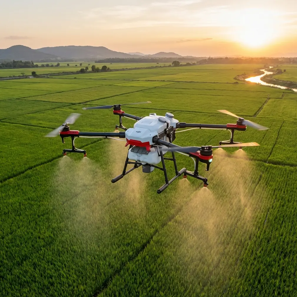
The Agras T50 is usually discussed through the lens of productivity: swath width, treatment efficiency, nozzle calibration, and stable path execution. That is understandable. It is an agricultural workhorse, not a studio camera platform.
Still, field capture matters. Operators document pre-treatment conditions, verify coverage, inspect canopy response, and record edge effects near waterways or salt-exposed boundaries. In coastal farming, those records can be the difference between a useful agronomy note and a folder of images that cannot support any serious interpretation.
The core principle from the camera reference is simple and technically correct: focus is the adjustment process that moves optical elements so that incoming light forms a clear, sharp image on the sensor. That definition seems elementary, but many drone operators work around it instead of with it. They assume altitude, a relatively small aperture, or a modern autofocus system will cover every scene. On a calm inland field, they may get away with that. Near the coast, where weather and subject conditions shift quickly, they often do not.
A soft image can conceal lodging patterns in one section of a field. It can blur the boundary between healthy foliage and stress-affected plants. It can reduce confidence when comparing one pass to the next. If you are trying to evaluate drift-sensitive margins or inspect treatment uniformity after a change in wind direction, image softness is not a cosmetic flaw. It is an operational limitation.
The morning start: stable conditions, strong RTK, clean captures
On the day that stays with me, we were documenting a coastal block with mixed exposure to wind and salt. The first hour was cooperative. The aircraft held a strong line, the RTK fix rate remained stable, and the T50 moved through its route with the kind of centimeter precision that makes agricultural waypoint work genuinely useful rather than merely efficient.
That precision matters for more than navigation. When you are comparing repeated captures of the same rows or field edges, positional consistency reduces ambiguity. You can return to the same problem area and know that differences in imagery are more likely to reflect crop or environmental change rather than a loose flight path.
The imaging side also began cleanly because we treated focus as a pre-flight discipline rather than a background assumption. Before committing to the route, we checked the intended subject distance, inspected the focus response under actual field contrast, and confirmed that the point of emphasis matched the agronomic purpose of the flight. Not the horizon. Not a bright reflective patch. The crop canopy itself.
This aligns with one of the most useful points in the source material: knowing “where to focus” is just as important as knowing how focus works. In crop capture, that means deciding whether the mission is about the upper canopy, a disease-suspect patch, field-edge vegetation, or infrastructure near the block. If the wrong visual plane is prioritized, the aircraft can execute perfectly while the imagery still fails the task.
Then the weather turned
Coastal weather rarely announces itself politely. It leans in.
Mid-flight, a bank of marine haze moved across the field from the water side. Light flattened. Contrast dropped. The wind did not become violent, but it became inconsistent, arriving in cross-field bursts that pushed foliage into motion and increased drift risk for any treatment-related planning. This is where operators who rely blindly on autofocus often lose the frame.
Autofocus systems generally perform best when contrast is distinct and the target is visually cooperative. Once haze, glare, and moving leaves enter the picture, AF can hunt. It may latch onto a high-contrast background element. It may settle slightly behind the intended canopy plane. It may simply hesitate long enough to cost the shot. The 2026 reference emphasized that switching between auto and manual focus is part of mastering the camera, not an advanced trick for specialists. In coastal drone work, that advice is operationally sound.
We adjusted in three ways.
First, we tightened our decision about the actual subject plane. The crop rows at the center of the block mattered more than the brighter reflective channel near the perimeter. Second, we reviewed focus area selection rather than leaving the system to interpret the scene broadly. Third, where AF confidence fell due to reduced contrast, we shifted our workflow to a more controlled focus approach before continuing critical passes.
That sequence sounds modest. It was not. It preserved the utility of the imagery when the environment became less forgiving.
Focus discipline and spray drift assessment belong in the same conversation
One reason coastal Agras T50 operations deserve a more integrated approach is that imaging and application planning are often discussed separately when, in reality, they inform each other.
Take spray drift. In a coastal field, wind direction and speed changes can alter risk profiles quickly, especially near exposed edges, roads, water boundaries, or neighboring crop zones. The visual record from the drone helps the operator evaluate canopy movement, boundary conditions, and treatment timing. But drift awareness depends on seeing those details clearly. If the image is soft because focus was mismanaged, visual cues become less trustworthy.
The same is true for nozzle calibration. Calibration is usually treated as a purely mechanical or flow-management task. Yet after calibration and route execution, the operator often needs a visual reference set to confirm field conditions, identify irregular canopy density, or document why a particular section may have required a different strategy. Sharp imagery improves that interpretation. It does not replace calibration data, but it makes the operational story coherent.
This is why I resist the tendency to frame camera setup as secondary on agricultural aircraft. On a T50 mission, visual clarity is part of decision quality.
Depth of field is not a license to be careless
Another useful thread from the source article is its treatment of depth of field. Many operators hear that term and reduce it to a false comfort: if enough of the scene appears “mostly sharp,” focus must be fine.
Not necessarily.
Depth of field can mask small errors in broad daylight, especially when you are not inspecting files critically. But “acceptable” sharpness and decision-grade sharpness are not the same thing. On a coastal block where leaves are moving and light is flattening, a little focus imprecision plus a little motion softness can quickly become a lot of uncertainty.
The article also mentions common “flip-over” scenarios, the sort of practical mistakes that ruin otherwise workable shoots. In field terms, those mistakes include letting the camera lock onto the wrong contrast zone, trusting a wide area AF mode in cluttered scenes, and failing to react when the environment changes. Those are ordinary errors. They are also exactly the kind that cut field-capture reliability.
How the Agras T50 handled the changing conditions
The aircraft itself remained composed.
This is where the T50’s agricultural design earns respect. The platform’s stable route execution helped preserve repeatability even as the weather became uneven. Its suitability for demanding farm environments matters in coastal work, especially where moisture, residue, and exposure challenge equipment over time. Features associated with ruggedized protection, such as an IPX6K level of resistance, are not abstract spec-sheet decoration in these settings. They matter because coastal operations expose aircraft to wet surfaces, mist, and contamination risks that less protected systems do not enjoy.
That resilience does not solve focus problems by itself, but it gives the operator a stable base from which to solve them. If the aircraft can hold the line, maintain reliable positioning, and keep route behavior predictable, then the imaging workflow becomes manageable even when the weather shifts mid-mission.
The RTK side deserves a second mention here. Centimeter precision is often praised for application accuracy, and rightly so. But in a field report context, it also improves the integrity of before-and-after imagery. When you revisit a section after a weather interruption or compare a stressed patch against a prior pass, positional confidence reduces guesswork. You spend less time asking, “Is this the same place?” and more time assessing what changed.
What this means for coastal operators using the T50
If your mission includes capturing field conditions, three practical lessons stand out.
1. Treat focus as a mission parameter
Do not leave it buried under camera defaults. The source material is correct: understanding focus, knowing where to place it, and knowing when to use autofocus versus manual control can dramatically improve your success rate. On the coast, that difference shows up fast.
2. Tie image sharpness to agronomic decisions
Soft canopy imagery weakens your ability to assess drift-sensitive edges, crop stress patterns, and post-calibration field context. This is not about aesthetics. It is about whether the image can support an action.
3. Prepare for the scene to change after takeoff
The day may start with clean contrast and easy AF performance, then turn hazy and unstable 20 minutes later. The T50 can continue to do its job under changing conditions, but only if the operator adapts camera behavior alongside flight behavior.
For teams building better coastal workflows, I often recommend documenting a repeatable checklist that includes subject plane selection, focus mode choice, RTK confirmation, and field-edge wind observation before the mission begins. If you need a practical discussion around that workflow, this direct line is useful in the field: message our agronomy drone desk.
A note on multispectral expectations
Some operators assume that if they are also running multispectral workflows elsewhere in their program, standard visual capture can be treated casually. That is a mistake. Multispectral data can reveal stress signatures beyond visible light, but ordinary visual imagery still carries enormous value for contextual interpretation, operator verification, and communication with growers. A sharp visible image of a coastal field edge, taken at the right moment, often clarifies what a data layer is actually showing.
So even in more advanced sensing programs, focus discipline remains foundational.
The real takeaway from this field report
The strongest lesson from that coastal T50 day was not dramatic. The drone did what a serious agricultural platform should do: it stayed reliable while the environment got less friendly. The decisive factor in capture quality was the operator’s willingness to respect focus as an operational control rather than an afterthought.
That insight is fully consistent with the 2026 camera reference. Soft images and weak subject separation usually trace back to poor focus handling. The same camera can produce far better results when focus is understood properly. And the practical variables it highlights, AF mode, focus area selection, depth of field, manual override, and recovery from common failure scenarios, all translate directly into better drone field documentation.
For coastal Agras T50 work, that is the difference between merely flying the route and actually seeing the field.
Ready for your own Agras T50? Contact our team for expert consultation.