How to Use the Agras T50 for Remote Construction Site Captur
How to Use the Agras T50 for Remote Construction Site Capture
META: A field-tested guide to using the DJI Agras T50 on remote construction sites, with practical advice on RTK fix rate, weather resistance, battery handling, swath control, and mission reliability.
Remote construction sites create a strange mix of urgency and uncertainty. Survey windows are short. Access roads are rough. Cellular coverage is often unreliable. And if a project manager asks for updated site visibility before the next concrete pour, nobody wants to hear that the aircraft stayed grounded because positioning drifted or batteries overheated in the truck.
That is where the Agras T50 becomes interesting, even outside its agricultural roots.
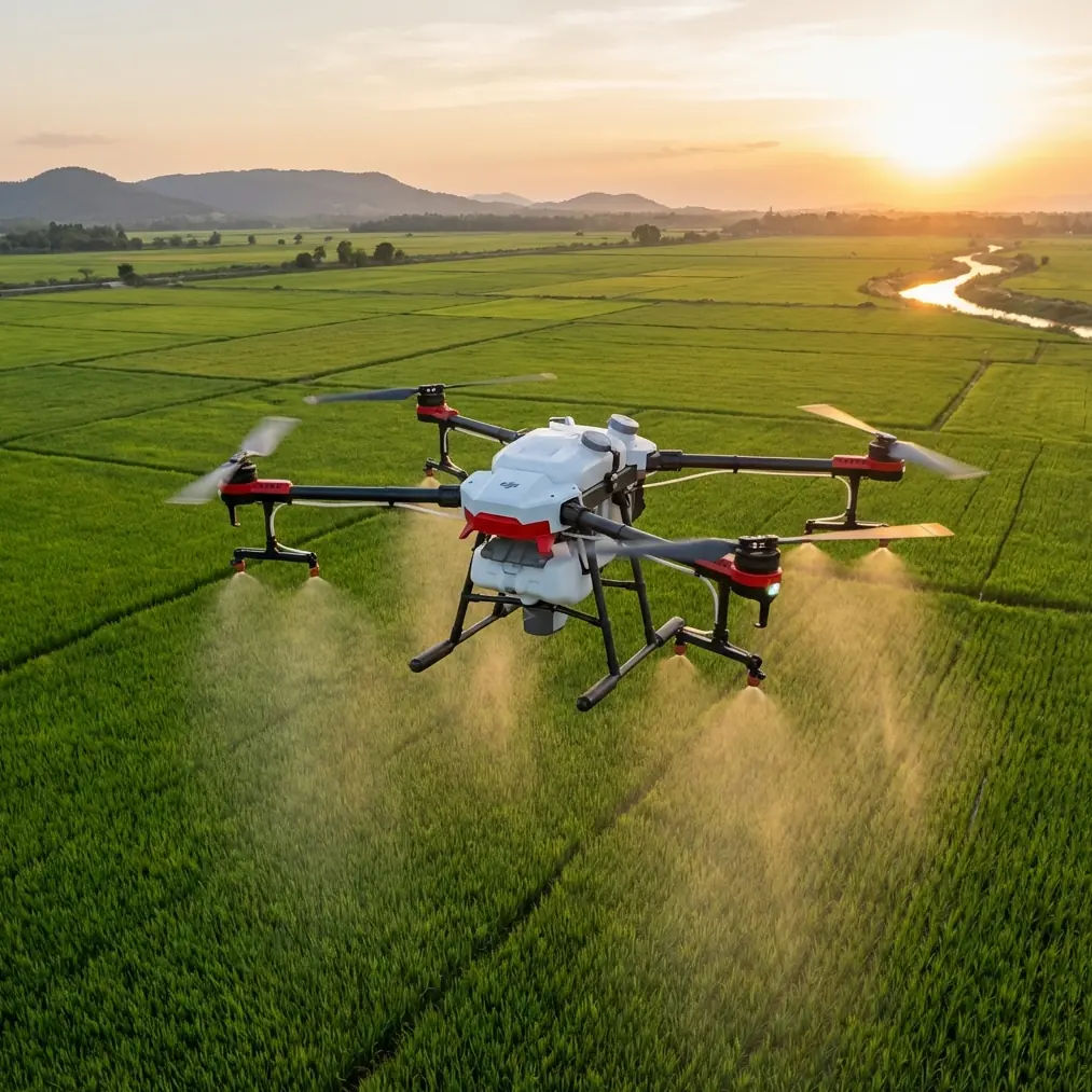
Most people first associate the T50 with spraying and spreading. Fair enough. But some of the same characteristics that make it useful over large fields also matter when you need repeatable aerial coverage over isolated construction sites: stable low-altitude flight, predictable path control, resistance to dirty environments, and enough operational efficiency to keep moving without constant resets. For remote capture work, those traits matter more than flashy marketing categories.
If you are considering the Agras T50 for documenting remote job sites, stockpile pads, access corridors, drainage work, or early-phase civil construction, the right question is not simply whether it can fly there. The real question is whether it can deliver consistent, decision-ready coverage under field conditions that punish weak workflows.
Start with the mission, not the airframe
Construction capture is not agriculture, even if the aircraft overlaps. On a remote site, you are usually trying to accomplish one of four things:
- establish current conditions before a work package begins
- track progress against a grading or earthmoving plan
- inspect a difficult or unsafe area without sending people on foot
- create repeatable visual records for stakeholders who are not on site
That changes how you configure the T50.
The objective is not maximizing spray output or broad-acre treatment efficiency. It is disciplined route planning, reliable geolocation, and image consistency from one flight day to the next. If your capture pattern changes every time you launch, your comparison value drops sharply. Earthwork quantities, haul-road development, slope changes, and drainage patterns become harder to interpret.
This is where centimeter precision matters. If the aircraft maintains a strong RTK fix rate, repeated passes over the same corridor or work zone become much more useful. On a remote construction site, even small positional inconsistencies can create confusion when teams compare progress between weeks. A retaining wall alignment that appears shifted by a small margin in the imagery may not reflect actual construction error at all; it may just be bad positioning discipline. Strong RTK performance reduces that risk.
Why RTK fix rate matters more in remote construction than many teams realize
RTK fix rate sounds technical until a project timeline depends on it.
In practice, the difference between a stable high-quality RTK solution and a weak or intermittent fix shows up in the usefulness of the final record. Construction teams often need to compare imagery against previous flights, design surfaces, or field notes taken by survey crews. If positional consistency drifts, the whole comparison exercise becomes noisy.
On remote projects, that problem gets worse because you may not have ideal correction delivery. Tree lines, terrain breaks, and weak network service can interrupt your positioning workflow. When that happens, operators often compensate by flying anyway and hoping the site context remains “good enough.” That is a mistake.
A better operating standard is to treat RTK fix rate as a go/no-go metric for documentation flights that need repeatability. If the site requires centimeter precision for recurring progress capture, do not normalize degraded fixes. Wait, reposition, or adjust the workflow. The value of the record is tied directly to geospatial trust.
Operationally, this matters for:
- cut-and-fill monitoring
- haul road alignment checks
- drainage path verification
- perimeter and setback documentation
- progress comparisons for owners and contractors
If your site team ever had a meeting derailed by inconsistent map alignment, you already understand how costly weak positional discipline can be.
The overlooked advantage of an IPX6K-class platform on dirty job sites
Construction sites punish equipment in ways clean office planning never anticipates. Dust coats sensors. Mud splashes onto folding joints. Fine particulates settle everywhere. Water trucks turn dry areas into slurry, then midday heat bakes residue into every exposed surface.
That is why an IPX6K rating has operational significance here. It is not a decorative spec. It directly affects whether the aircraft can remain dependable through repeated deployment in harsh outdoor conditions. A remote construction site is rarely kind to electronics, especially when an operator is launching near aggregate piles, fresh grading zones, or active access roads.
For the T50, weather and contamination resistance matter because field uptime matters. If you need to document a site after rain, near slurry basins, or around dust-heavy earthmoving activity, resilience reduces downtime between missions and lowers the chance that routine environmental exposure turns into maintenance disruption.
This does not mean you should treat the drone carelessly. It means the platform is better suited to real field abuse than lighter-duty systems that perform well only when conditions remain tidy. That distinction becomes obvious after a few weeks on a remote civil project.
Swath width is not just an agricultural term
Construction operators often ignore the phrase “swath width” because it sounds tied to crop application. That leaves useful planning value on the table.
For capture operations, swath thinking helps you define how much ground each pass covers while preserving enough overlap and visual consistency for your intended output. On a broad remote site, the T50’s ability to work methodically across large areas can be an advantage, but only if the operator plans coverage width with purpose.
Too wide, and you may lose the detail needed for edge conditions, trench development, spoil placement, or erosion tracking. Too narrow, and you waste battery cycles on unnecessary overlap while daylight slips away.
In practical field terms, swath planning helps you answer three questions:
- how many passes are needed to document the active work area
- whether your battery inventory supports the mission without rushed turnarounds
- how consistent your visual record will be across repeated capture days
This becomes especially useful on linear or segmented sites such as access roads, utility corridors, temporary drainage channels, or perimeter works where the area of interest is irregular rather than neatly rectangular.
A field battery tip that saves more missions than most checklists
Here is the battery management lesson I see teams learn the hard way: do not move a warm pack from charging or truck storage straight into a demanding remote mission without letting it stabilize.
That sounds minor. It is not.
Remote construction capture usually means long drives, limited shade, and improvised staging areas. Batteries often sit in hot vehicle compartments, then get rushed into service because the site superintendent wants an update before equipment moves. The result can be inconsistent performance right when the aircraft needs steady power for a repeatable mission profile.
My rule in the field is simple. Treat battery temperature like part of your preflight, not an afterthought. Keep packs out of direct sun, rotate them deliberately, and allow recently charged batteries to rest before launch. A few minutes of thermal patience prevents far more trouble than it costs. You get steadier discharge behavior, more predictable mission execution, and less temptation to cut corners on route completion.
On remote sites, one battery issue is never just one battery issue. It can mean losing the only clean weather window of the day, delaying image delivery, or forcing a partial refly when site machinery has already changed the terrain. Good battery handling protects the integrity of the record, not just the aircraft.
Nozzle calibration still matters, even when capture is the focus
At first glance, nozzle calibration seems irrelevant if your immediate goal is site imaging rather than spraying. But the discipline behind calibration tells you something important about how the T50 should be operated: precision inputs create usable outputs.
If a team also uses the same platform for dust suppression support, vegetation control along access margins, or adjacent land management, poor nozzle calibration introduces spray drift risk. And spray drift on or near a construction site is not a trivial issue. It can affect exposed materials, nearby personnel zones, or drainage-sensitive areas.
That is why spray drift belongs in the operational conversation even for readers focused on construction capture. The T50 is a capable platform, but multi-role use demands tight procedures. If the aircraft transitions between application work and documentation work, calibration discipline prevents one mission type from compromising the next. It also reinforces a broader point: the most successful field operators are not the ones with the most features; they are the ones with the most repeatable process.
When remote means disconnected, workflow simplicity wins
A remote site exposes weak workflows quickly. If your operation depends on perfect network coverage, constant cloud syncing, or too many handoffs between field and office, the process becomes brittle.
The T50 is best used here as part of a simple chain:
- define the capture objective before arrival
- verify positioning quality on site
- fly repeatable paths with known coverage logic
- manage batteries conservatively
- transfer records cleanly with minimal field improvisation
That sounds almost boring. Good. Boring workflows survive rough roads, schedule pressure, and changing weather.
I also advise teams to standardize what they capture on every visit: entry road condition, stockpile boundaries, active earthwork zone, drainage paths, and critical structures. That repeatability helps stakeholders recognize change quickly. If you need help tailoring a practical field checklist, this direct project chat link fits naturally into a site-ops workflow without adding another bloated system.
What about multispectral expectations?
The word “multispectral” often appears in drone discussions because people want more analytical depth from aerial data. For some remote construction contexts, that can be useful around revegetation monitoring, sediment control performance, or environmental compliance zones near active work.
But for most core construction capture tasks with the T50, the immediate value is not exotic sensor theory. It is dependable, repeatable site visibility. Teams should avoid overcomplicating the mission concept. If the requirement is progress verification, access monitoring, or condition tracking, operational consistency matters more than chasing specialized outputs that the site team may not actually use.
Use the right tool for the actual question. If the question is “Did the grading advance as planned since last Thursday?” then repeatable flight paths, strong RTK performance, and disciplined battery handling are worth more than fashionable analytics.
A practical setup for remote construction capture with the T50
If I were deploying the Agras T50 for this exact scenario, I would keep the method straightforward.
First, define one repeatable flight template for the whole site and one for the active work zone. The full-site mission gives management context. The tighter mission captures the work that changed.
Second, verify RTK status before every launch and record whether fix quality remained stable through the flight. That creates accountability and protects against misleading comparisons later.
Third, plan pass spacing with swath width in mind. Cover enough ground efficiently, but do not sacrifice the detail needed to identify meaningful site changes.
Fourth, inspect the aircraft after every dusty or wet operation. IPX6K-class protection helps, but field grime accumulates fast on remote projects. Reliability comes from resilience plus routine care.
Fifth, manage batteries as if they determine the quality of your data, because they do. In real field conditions, they often do exactly that.
The bigger takeaway
The Agras T50 is not a conventional answer to remote construction site capture. That is precisely why it deserves a serious look. Its value is not that it fits neatly into a category. Its value is that several of its practical strengths—rugged environmental tolerance, methodical large-area coverage, and the potential for centimeter precision when RTK conditions are right—map well to the realities of isolated project sites.
For teams working far from easy logistics, those strengths are not abstract specifications. They affect whether a flight happens on schedule, whether the imagery aligns from one visit to the next, and whether the resulting record supports real operational decisions.
That is the standard that matters.
Ready for your own Agras T50? Contact our team for expert consultation.