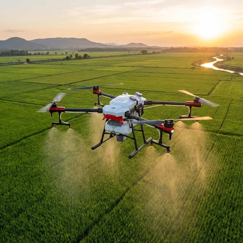
Agras T50 in an Urban Coastline Capture Workflow
Agras T50 in an Urban Coastline Capture Workflow: What the Data Really Suggests
META: A case-study analysis of Agras T50 operations for urban coastline capture, connecting geotagged ArcGIS workflows, WGS 84 imagery handling, altitude discipline, RTK-style precision thinking, and China’s first compulsory drone liability insurance case in Chongqing.
Urban coastline work looks simple from a distance. Fly the edge, collect the imagery, build the map. On site, it is rarely that tidy.
Sea walls, river mouths, reclaimed land, port-side structures, mixed public access, reflective water, and dense urban margins create a tougher operating environment than many agricultural crews expect. That is exactly why the Agras T50 deserves a more serious conversation than generic “can it fly here?” commentary. The real question is whether the aircraft can be folded into a disciplined capture workflow that is defensible operationally, spatially reliable, and insurable in a third-party risk environment.
That last point suddenly matters more in China than it did a year ago. Recent reporting from UAVCN noted that Chongqing has implemented the country’s first compulsory drone liability insurance case, described as a national first in the practical rollout of a drone responsibility insurance regime. The significance is not bureaucratic trivia. It changes how professional operators should think about aircraft selection, route planning, documentation, and accountability whenever flights involve meaningful third-party exposure.
For an Agras T50 team asked to document urban coastlines, this is the backdrop that matters: not just flight capability, but whether every mission can stand up to scrutiny after the fact.
Why this matters for Agras T50 users specifically
The Agras T50 is often discussed through an agriculture lens: swath width, droplet behavior, nozzle calibration, drift management, acreage productivity. Those topics are valid. But many professional teams using agricultural UAV platforms are also pulled into adjacent civilian tasks such as corridor documentation, embankment monitoring, shoreline change observation, drainage inspection, and site condition capture around peri-urban edges. In those assignments, the aircraft is no longer judged only by coverage efficiency. It is judged by how cleanly its data can be traced from image capture to mapped output.
The reference materials here point to a very practical answer. Both ArcGIS solution documents show a workflow in which source imagery is stored in a project folder, recognized under the WGS 84 coordinate system, and automatically placed on the map using image metadata. One document explicitly shows 523 images loaded into the project. Another extract lists individual image coordinates and altitudes such as DJL0001.JPG at latitude 30.5032024, longitude 104.4251354, altitude 605.109. The software then places photos at shooting locations and connects them into a visible flight track.
That sounds ordinary until you apply it to an urban coastline environment. Suddenly, those details tell you three useful things:
The workflow rewards disciplined geotagging.
If your T50 mission data arrives with consistent location metadata, post-processing becomes much more defensible.Altitude consistency is not a cosmetic issue.
In the reference sequence, the listed altitudes cluster tightly around 604.6 to 605.1. That kind of narrow variation matters when you want even ground sampling and predictable overlap along seawalls, promenades, or revetments.The flight line itself becomes an audit trail.
When ArcGIS links images into a route, you are not just building a map. You are creating evidence of where the aircraft went, what it saw, and how systematically the mission was flown.
For operators working in a space now shaped by compulsory third-party liability expectations, that audit trail is operationally significant.
A practical case: capturing an urban coastline with an Agras T50
Let’s make this concrete.
Imagine a municipal or contractor team using an Agras T50 to document a built coastline: concrete edges, drainage outfalls, erosion transitions, landscaping strips, pedestrian interfaces, and adjacent construction staging. The mission is not crop spraying. It is visual capture and location-aware site recording in a difficult edge zone where water and people are both present.
In that setting, the T50 should be treated less like a blunt coverage machine and more like a structured collection platform.
The ArcGIS references suggest the right discipline. A project folder is created first. Source imagery is ingested next. Each image carries metadata including latitude, longitude, and altitude under WGS 84. Once loaded, the system places each image at the point of capture and draws the route line. This is exactly the sort of chain of custody that urban clients increasingly expect.
For coastline work, that matters because the hardest disputes are rarely about whether the drone flew. They are about whether a defect, encroachment, or shoreline change can be tied to a precise location and date. If a cracked sea barrier section appears in one frame, the image is more useful when it sits on a mapped point rather than in a loose photo archive.
The operational significance of WGS 84 and route-linked imagery
WGS 84 is easy to overlook because it is so common. But in mixed urban-coastal projects, common standards save time.
When imagery arrives already aligned to WGS 84, it fits more cleanly into broader GIS environments, especially when multiple teams are working across planning, engineering, environmental review, and maintenance. That alone reduces friction. An Agras T50 team can hand off data that is easier to place against basemaps, shoreline layers, utility records, or historical survey information.
The second reference detail, the 523-image dataset, also says something useful about scale. Urban coastline capture is often image-heavy because linear features demand repetition and overlap rather than isolated shots. A dataset in the hundreds is not excessive; it is often the minimum needed to preserve continuity along long, narrow sites. If a T50 operator plans only for “a few good photos,” the dataset tends to fail when someone later asks for adjacent context, continuity between frames, or proof of route completeness.
This is where RTK thinking enters the conversation, even if the source documents themselves center on metadata-driven GIS handling rather than a hardware spec sheet. For coastline capture near dense urban edges, RTK fix rate is not just a bragging point. It affects how often your geotagged positions are trustworthy enough to support engineering or asset management decisions. A mapped shoreline crack or blocked outfall does not help much if its recorded location wanders several meters between passes.
Centimeter-level expectations are not always required for every civilian documentation job, but the closer your workflow gets to maintenance planning or legal defensibility, the more centimeter precision stops being optional and starts becoming a standard.
Optimal flight altitude: the insight that matters here
The source extracts include image altitudes around 605 meters in absolute terms. That number should not be copied blindly into an Agras T50 mission plan because it reflects the recorded elevation context in that specific dataset, not a universal recommended above-ground level.
What is valuable is the pattern: the altitude remains remarkably stable from image to image. For urban coastline capture, that consistency is the real lesson.
My practical recommendation for the T50 in this scenario is to prioritize a steady, moderate above-ground operating height that minimizes rapid altitude swings, especially when passing between embankments, open water edges, and built infrastructure. In most urban shoreline capture tasks, the best results come not from flying as high as possible, but from choosing an altitude that preserves façade and edge detail while keeping overlap and route predictability intact. Too low, and you lose continuity, increase obstruction risk, and exaggerate perspective distortion. Too high, and subtle defects in barriers, drains, surface washout, or slope transitions become harder to interpret.
So the useful altitude insight from the reference data is this: uniformity beats improvisation. The tightly grouped values around 605 suggest a capture run designed to keep the imaging geometry stable. For T50 operators, that translates into smoother terrain-following logic, cleaner overlap, and more reliable downstream analysis.
What an agriculture platform teaches us about coastline discipline
Agras crews already understand a few concepts that transfer directly.
Spray drift awareness, for example, is really a wind-awareness mindset. On a coastline, wind can shift abruptly due to open water exposure and urban channeling between structures. Even if the mission is imaging rather than application, that same discipline helps prevent track deviation and inconsistent image spacing.
Nozzle calibration might sound irrelevant here, but the deeper principle is not. Calibration culture means the crew is accustomed to checking the system before flight rather than assuming yesterday’s settings still work today. In coastline capture, the equivalent is verifying camera alignment, metadata integrity, storage paths, coordinate settings, and route parameters before takeoff. A team that calibrates its spray system well usually adapts faster to rigorous sensor and mapping checks.
Swath width has a conceptual cousin too. Along a shoreline, the question becomes corridor width: how much waterfront, toe slope, crest, walkway, and adjacent built frontage should each pass include? If the corridor is too narrow, the dataset loses context. If it is too wide, resolution and consistency may suffer. Good operators define that corridor intentionally.
And in exposed environments, ruggedization matters. A platform expected to work near salt-laden air, splash-prone edges, and damp infrastructure benefits from hardening traits associated with IPX6K-class durability thinking. That does not mean invincibility; it means the aircraft is better suited to real field conditions than a lighter-duty system that performs well only on benign inland days.
Insurance changes the mission design mindset
The Chongqing insurance milestone should not be treated as a side note. A compulsory liability framework centered on third-party risk from drone flight changes operator behavior in healthy ways.
For an Agras T50 mission over or near urban coastline infrastructure, that means:
- route discipline is no longer just a best practice;
- image geolocation is no longer just convenient;
- project folder structure is no longer admin housekeeping;
- and documented flight traces are no longer optional extras.
If an incident occurs, or if a stakeholder later challenges what was captured and where, the value of a mapped image sequence becomes obvious. The ArcGIS workflow shown in the references—photos ingested, geolocated via metadata, connected into a visible trajectory—supports a more professional standard of accountability.
That is one reason I would argue the T50 conversation should expand beyond payload and field productivity. In higher-exposure civilian jobs, the more useful question is whether your end-to-end workflow can explain itself clearly. The aircraft is one part of that answer. The data chain is the rest.
Building a better coastline capture stack around the T50
A strong urban-coastal workflow with the Agras T50 should aim for five things:
Consistent altitude behavior
Not necessarily one universal number, but one stable imaging geometry.Reliable geotagging under WGS 84
This keeps data portable and easy to integrate.High RTK fix confidence where precision matters
Especially near engineered assets and inspection targets.Structured image management from the start
The “create project folder first” logic in the ArcGIS references is simple and smart.A route record that can be reviewed later
If the software can place each image and draw the flight line, post-mission review becomes far more useful.
When teams ask how to adapt the T50 for mixed civilian mapping or capture assignments, I usually tell them to think less about improvising in the air and more about preserving order on the ground. The best missions feel almost boring in post-processing because everything lines up exactly where it should.
If you are designing that kind of workflow and want to compare planning approaches, this direct project channel can help: message the flight workflow team.
The real takeaway
The reference data does not hand us a glossy marketing story. It gives us something better: a glimpse of how professional UAV operations are becoming more structured.
A national-first compulsory drone liability insurance case in Chongqing points toward tighter expectations around responsibility. The ArcGIS examples show the nuts and bolts of traceable imagery handling: WGS 84, a 523-image project, image-by-image coordinates, and a route reconstructed automatically from metadata. Put those together, and a clear lesson emerges for Agras T50 users working on urban coastlines.
Success is not just about getting airborne. It is about flying in a way that produces a stable, mappable, reviewable record of the site.
For coastline capture in urban conditions, the smartest altitude choice is the one you can hold consistently. The smartest route is the one your GIS can reconstruct cleanly. And the smartest operator is the one who understands that precision, documentation, and liability are now part of the same mission.
Ready for your own Agras T50? Contact our team for expert consultation.