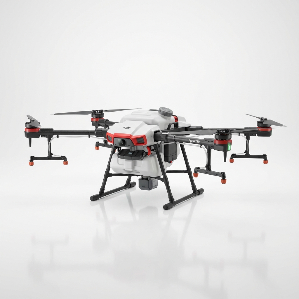
Agras T50 Obstacle Avoidance Performance: Conquering Post-Rain Corn Field Inspections When Ground Access Fails
Agras T50 Obstacle Avoidance Performance: Conquering Post-Rain Corn Field Inspections When Ground Access Fails
TL;DR
- The Agras T50's omnidirectional binocular vision system and dual phased-array radar enable safe autonomous navigation through standing corn at heights exceeding 3 meters, even when muddy conditions prevent ground-based scouting
- IPX6K rating ensures reliable operation during humid post-rain conditions when moisture and debris could compromise lesser systems
- Proper obstacle avoidance configuration reduces inspection time by up to 65% compared to manual flight modes in complex crop canopy environments
- RTK Fix rate maintenance above 95% proves critical for repeatable flight paths during multi-day inspection campaigns
- Battery management in temperature-variable conditions directly impacts obstacle detection response time and overall mission safety
Mud swallows tractor tires. Standing water pools between rows. Your agronomist needs damage assessment data from yesterday's storm, but the field won't support vehicle traffic for another three days. This scenario plays out across corn-growing regions every season, and it's precisely where aerial inspection technology demonstrates its operational value.
The question isn't whether a drone can fly over a corn field. The question is whether your platform can navigate autonomously through a complex three-dimensional environment where crop height varies, damaged stalks lean at unpredictable angles, and post-storm debris creates detection challenges that separate professional-grade equipment from consumer toys.
Understanding the Post-Rain Inspection Challenge
Corn fields after significant rainfall present a unique combination of obstacles that stress every component of an autonomous navigation system. The crop canopy itself creates a dense vertical environment, but storm damage introduces horizontal complexity that standard flight planning cannot anticipate.
Lodged corn—stalks bent or broken by wind and water weight—creates irregular obstacle profiles that change from row to row. Standing water reflects radar signals unpredictably. High humidity affects sensor clarity. Ground-based reference points become obscured.
For service providers conducting inspection flights, these conditions demand equipment that responds intelligently to real-time environmental data rather than relying solely on pre-programmed flight paths.
Why Obstacle Avoidance Matters More Than Speed
Many operators prioritize coverage speed when evaluating agricultural drones. This metric matters for routine applications, but inspection scenarios flip the priority hierarchy.
A single collision with a leaning stalk can end your mission, damage your equipment, and delay the data delivery your client needs. The Agras T50's approach to obstacle detection addresses this reality through redundant sensing systems that maintain awareness across all approach vectors.
Expert Insight: After flying hundreds of post-storm inspection missions, I've learned that the first pass should always run at 70% of normal autonomous speed. This gives the obstacle avoidance system additional processing time to evaluate irregular crop profiles. Once you've confirmed the field conditions match your planning assumptions, subsequent passes can increase velocity. The time lost on that first conservative pass is always recovered through uninterrupted operations.
Agras T50 Obstacle Avoidance Architecture: Technical Analysis
The T50 integrates multiple detection technologies into a unified awareness system. Understanding how these components interact helps operators configure optimal settings for specific field conditions.
Sensor Fusion Approach
The platform combines binocular vision cameras with phased-array radar to create overlapping detection zones. This redundancy matters because each technology has specific strengths and limitations in agricultural environments.
Vision systems excel at detecting fine structural details—individual stalks, leaves, irrigation equipment. They struggle in low-light conditions and can be confused by uniform textures.
Radar penetrates light vegetation and maintains performance regardless of lighting conditions. It provides reliable distance measurement but offers less detail about obstacle shape and composition.
By fusing data from both systems, the T50 builds a more complete environmental model than either technology achieves independently.
Detection Range and Response Parameters
| Parameter | Specification | Post-Rain Corn Relevance |
|---|---|---|
| Forward Detection Range | 50 meters | Provides adequate response time at inspection speeds |
| Lateral Detection Range | 35 meters | Critical for row-following in damaged sections |
| Vertical Detection Range | 40 meters | Accommodates corn heights plus safety margin |
| Minimum Detection Size | Objects >10cm diameter | Detects lodged stalks and debris |
| Response Time | <0.1 seconds | Enables real-time path adjustment |
| Operating Humidity Range | Up to 95% RH | Handles post-rain atmospheric conditions |
The IPX6K rating deserves specific attention for post-rain operations. This certification means the system withstands high-pressure water jets from any direction—a standard that ensures morning dew, residual moisture on vegetation, and humid air don't compromise sensor performance.
Comparative Analysis: Obstacle Avoidance Approaches in Agricultural Drones
Not all obstacle avoidance systems deliver equivalent performance in complex crop environments. Understanding the technical differences helps service providers make informed equipment decisions.
Detection Technology Comparison
| Technology Type | Corn Canopy Performance | Moisture Sensitivity | Power Consumption |
|---|---|---|---|
| Ultrasonic Only | Limited range, sound absorption by foliage | Moderate | Low |
| Single-Camera Vision | Texture confusion in uniform crops | High | Moderate |
| Binocular Vision | Strong depth perception, detail recognition | Moderate | Moderate |
| Single Radar | Good penetration, limited detail | Low | High |
| Fused Vision + Radar (T50) | Comprehensive awareness, redundant detection | Low | Moderate |
The T50's fusion approach addresses the specific weaknesses that make single-technology systems unreliable in agricultural settings. When vision sensors encounter challenging lighting during early morning inspections, radar maintains situational awareness. When radar signals scatter off wet foliage, vision systems provide backup detection.
Swath Width Implications for Inspection Efficiency
Obstacle avoidance capability directly affects achievable swath width during inspection flights. Platforms with limited detection range must fly narrower patterns to maintain safety margins, increasing total flight time and battery consumption.
The T50's 50-meter forward detection enables confident operation at full swath width even in variable crop conditions. This translates to fewer battery changes per field and faster data delivery to waiting agronomists.
Configuring Obstacle Avoidance for Corn Field Inspections
Default obstacle avoidance settings optimize for general agricultural operations. Post-rain corn inspections benefit from specific parameter adjustments that account for the unique environmental challenges.
Recommended Configuration Adjustments
Sensitivity Level: Increase to maximum for initial field assessment. The performance cost is minimal, and the protection against unexpected obstacles justifies conservative settings.
Braking Distance: Extend by 20% beyond default values. Wet conditions may affect stopping performance, and additional margin prevents close calls.
Altitude Hold Priority: Enable strict altitude maintenance. Post-rain fields often have uneven terrain profiles that could trigger unwanted altitude adjustments if the system interprets ground-level changes as obstacles.
RTK Baseline Monitoring: Configure alerts for RTK Fix rate drops below 95%. Consistent centimeter-level precision ensures repeatable flight paths if you need to return for follow-up inspection of specific areas.
Pro Tip: When inspecting corn fields with suspected lodging damage, configure your flight path perpendicular to the prevailing storm wind direction. Lodged stalks typically fall with the wind, meaning cross-wind flight paths encounter obstacles at more predictable angles. This orientation gives the obstacle avoidance system cleaner detection profiles and reduces the likelihood of stalks entering blind spots between sensor coverage zones.
Battery Management in Temperature-Variable Conditions
Post-rain environments often feature significant temperature swings. Morning inspections may begin in cool, humid conditions and extend into midday heat as cloud cover burns off. These temperature variations directly affect battery performance and, consequently, obstacle avoidance system responsiveness.
Temperature Effects on Flight Performance
Lithium-polymer batteries deliver optimal performance within a specific temperature range. Below 15°C, internal resistance increases, reducing available current for demanding maneuvers. Above 40°C, thermal management systems may throttle output to prevent damage.
Obstacle avoidance systems require consistent power delivery for real-time processing. When batteries operate outside optimal temperature ranges, response times may extend slightly—a factor that matters when navigating complex crop environments at speed.
Practical Temperature Management Protocol
Pre-Flight Conditioning: Store batteries in climate-controlled vehicles until immediately before use. Avoid leaving batteries in direct sunlight or cold morning air.
Rotation Strategy: Maintain at least three battery sets per aircraft for extended inspection campaigns. This allows adequate cooling time between flights while maintaining operational tempo.
Temperature Monitoring: The T50's battery management system reports cell temperatures in real-time. Establish personal thresholds—I recommend pausing operations if any cell exceeds 38°C during flight.
Post-Flight Handling: Allow batteries to cool to ambient temperature before charging. Charging warm batteries accelerates degradation and reduces long-term capacity.
Common Pitfalls in Post-Rain Corn Inspections
Even experienced operators encounter challenges when environmental conditions push beyond routine parameters. Recognizing common mistakes helps avoid costly errors.
Mistakes to Avoid
Ignoring Pre-Flight Sensor Checks: Moisture and debris accumulate on sensor surfaces during transport and setup. A quick visual inspection and lens cleaning takes thirty seconds and prevents degraded obstacle detection performance.
Flying Too Soon After Rain Stops: Atmospheric moisture remains elevated for hours after precipitation ends. Wait until relative humidity drops below 85% for optimal sensor clarity.
Underestimating Crop Height Variation: Storm damage creates height differentials within single fields. Plan flight altitudes based on maximum standing crop height plus a 5-meter safety buffer, not average height.
Neglecting Ground Station Positioning: RTK base station placement affects fix rate consistency. Position ground equipment on stable, elevated surfaces away from standing water that could cause signal reflection.
Rushing Post-Storm Assessments: Clients want data quickly, but compromised operations don't serve anyone. Build realistic timelines that account for environmental challenges.
Integrating Inspection Data with Treatment Planning
Obstacle avoidance capability enables more than safe flight—it supports the data collection workflows that drive treatment decisions. The T50's stable flight characteristics during complex navigation produce cleaner imagery for NDVI analysis and multispectral mapping.
From Inspection to Application
Post-rain inspections often reveal damage patterns requiring targeted treatment. The same platform that navigates safely through damaged corn for assessment can return for variable rate application once conditions permit ground-based equipment access.
This operational continuity—inspection, analysis, treatment—represents the service provider value proposition. Clients receive integrated solutions rather than fragmented data handoffs.
Spray drift management during subsequent applications benefits from the detailed field knowledge gained during inspection flights. Understanding where lodging occurred, where standing water collected, and where crop density varies enables precise nozzle calibration and application parameter adjustment.
Frequently Asked Questions
How does the Agras T50 handle obstacle detection when corn tassels create dense canopy layers?
The T50's binocular vision system distinguishes between solid obstacles and permeable vegetation based on texture analysis and depth mapping. Tassels register differently than stalks or equipment, allowing the system to maintain appropriate clearance without excessive altitude increases that would compromise inspection data quality.
What RTK Fix rate should I maintain for reliable obstacle avoidance during inspection flights?
Target a minimum 95% RTK Fix rate throughout your mission. Lower fix rates introduce position uncertainty that can cause the obstacle avoidance system to make unnecessary corrections or miss genuine obstacles. If fix rate drops consistently, evaluate base station positioning and satellite visibility before continuing operations.
Can I conduct inspections during active light rain if the field assessment is urgent?
The IPX6K rating protects against water exposure, but active precipitation affects sensor performance. Light mist is generally acceptable, but visible rain drops on sensor surfaces degrade detection accuracy. Wait for precipitation to stop and allow surfaces to dry before launching.
How do I adjust obstacle avoidance settings for fields with irrigation pivot structures?
Metal irrigation equipment presents strong radar returns that the system detects reliably. Configure your flight path to maintain minimum 15-meter horizontal clearance from pivot structures. The T50's lateral detection range provides adequate warning, but irrigation equipment doesn't move—plan around it rather than relying on real-time avoidance.
What's the recommended inspection altitude for post-storm corn damage assessment?
Fly at maximum standing crop height plus 8-10 meters for initial assessment passes. This altitude provides clear obstacle avoidance margins while capturing sufficient detail for damage evaluation. Lower altitude passes for detailed imaging should only occur after confirming field conditions and obstacle locations.
Post-rain corn field inspections demand equipment that performs reliably when conditions challenge every system component. The Agras T50's integrated obstacle avoidance architecture—combining binocular vision, phased-array radar, and robust environmental protection—delivers the operational confidence service providers need to accept challenging missions.
Your clients face weather damage. Their fields remain inaccessible. The data they need to make treatment decisions sits waiting in standing corn. The right equipment transforms that challenge into a service opportunity.
Contact our team for a consultation on configuring the Agras T50 for your specific inspection requirements and regional crop conditions.